
Chelsea, Massachusetts: Difference between revisions
Herostratus (talk | contribs) rmv obscurity from lede |
Mr.Shadow514 (talk | contribs) No edit summary Tags: Visual edit Mobile edit Mobile web edit |
||
| (40 intermediate revisions by 29 users not shown) | |||
| Line 1: | Line 1: | ||
{{Multiple issues|{{Overly detailed|date=April 2024}} |
|||
{{Essay-like|date=October 2023}} |
|||
{{Peacock|date=October 2023}}}} |
|||
{{Use mdy dates|date=July 2023}} |
{{Use mdy dates|date=July 2023}} |
||
{{Infobox settlement |
{{Infobox settlement |
||
|official_name |
| official_name = Chelsea |
||
|nickname |
| nickname = |
||
|motto |
| motto = |
||
|image_skyline |
| image_skyline = Tobin_bridge_crop.jpg |
||
|imagesize |
| imagesize = |
||
|image_caption |
| image_caption = The [[Tobin Bridge]], linking Chelsea and Boston |
||
|image_seal |
| image_seal = Seal of Chelsea, Massachusetts.png |
||
|image_flag |
| image_flag = Flag of Chelsea, Massachusetts.gif |
||
|image_map |
| image_map = Suffolk County Massachusetts incorporated and unincorporated areas Chelsea highlighted.svg |
||
|map_caption |
| map_caption = Location in [[Suffolk County, MA|Suffolk County]] and the state of [[Massachusetts]] |
||
|pushpin_map |
| pushpin_map = Boston Metro#Massachusetts#USA |
||
| subdivision_type = Country |
|||
|pushpin_map_caption = Location in the United States |
|||
| subdivision_name = United States |
|||
|subdivision_type = Country |
|||
| subdivision_type1 = [[U.S. state|State]] |
|||
|subdivision_name = United States |
|||
| subdivision_name1 = [[Massachusetts]] |
|||
|subdivision_type1 = [[U.S. state|State]] |
|||
| |
| subdivision_type2 = [[List of counties in Massachusetts|County]] |
||
| |
| subdivision_name2 = [[Suffolk County, Massachusetts|Suffolk]] |
||
| established_title = Settled |
|||
|subdivision_name2 = [[Suffolk County, Massachusetts|Suffolk]] |
|||
| established_date = 1624 |
|||
|established_title = Settled |
|||
| established_title2 = Incorporated (town) |
|||
|established_date = 1624 |
|||
| established_date2 = 1739 |
|||
|established_title2 = Incorporated (town) |
|||
| established_title3 = Incorporated (city) |
|||
|established_date2 = 1739 |
|||
| established_date3 = 1857 |
|||
|established_title3 = Incorporated (city) |
|||
| government_type = [[Council-manager government|Council–manager]] |
|||
|established_date3 = 1857 |
|||
| |
| leader_title = [[City manager]] |
||
| |
| leader_name = Fidel Maltez |
||
| area_magnitude = |
|||
|leader_name = Ned Keefe |
|||
| area_total_km2 = 6.39 |
|||
|area_magnitude = |
|||
| area_total_sq_mi = 2.47 |
|||
|area_total_km2 = 6.39 |
|||
| |
| area_land_km2 = 5.75 |
||
| area_land_sq_mi = 2.22 |
|||
|area_land_km2 = 5.75 |
|||
| |
| area_water_km2 = 0.64 |
||
| area_water_sq_mi = 0.25 |
|||
|area_water_km2 = 0.64 |
|||
| population_as_of = [[2020 United States Census|2020]] |
|||
|area_water_sq_mi = 0.25 |
|||
| settlement_type = [[List of municipalities in Massachusetts|City]] |
|||
|population_as_of = [[2020 United States Census|2020]] |
|||
| population_total = 40787 |
|||
|settlement_type = [[List of municipalities in Massachusetts|City]] |
|||
| population_density_km2 = 7097.87 |
|||
|population_total = 40787 |
|||
| population_density_sq_mi = 18380.80 |
|||
|population_density_km2 = 7097.87 |
|||
| elevation_m = 3 |
|||
|population_density_sq_mi = 18380.80 |
|||
| |
| elevation_ft = 10 |
||
| |
| timezone = [[Eastern Standard Time Zone|Eastern]] |
||
| utc_offset = −5 |
|||
|timezone = [[Eastern Standard Time Zone|Eastern]] |
|||
| timezone_DST = [[Eastern Standard Time Zone|Eastern]] |
|||
|utc_offset = −5 |
|||
| utc_offset_DST = −4 |
|||
|timezone_DST = [[Eastern Standard Time Zone|Eastern]] |
|||
| coordinates = {{coord|42|23|30|N|71|02|00|W|region:US-MA|display=inline,title}} |
|||
|utc_offset_DST = −4 |
|||
| website = [http://www.chelseama.gov www.chelseama.gov] |
|||
|coordinates = {{coord|42|23|30|N|71|02|00|W|region:US-MA|display=inline,title}} |
|||
| postal_code_type = ZIP Code |
|||
|website = [http://www.chelseama.gov www.chelseama.gov] |
|||
| |
| postal_code = 02150 |
||
| |
| area_code = [[Area code 617|617]]/[[Area code 857|857]] |
||
| |
| blank_name = [[Federal Information Processing Standard|FIPS code]] |
||
| blank_info = 25-13205 |
|||
|blank_name = [[Federal Information Processing Standard|FIPS code]] |
|||
| blank1_name = [[Geographic Names Information System|GNIS]] feature ID |
|||
|blank_info = 25-13205 |
|||
| blank1_info = 0612723 |
|||
|blank1_name = [[Geographic Names Information System|GNIS]] feature ID |
|||
| |
| pop_est_as_of = |
||
| pop_est_footnotes = |
|||
|pop_est_as_of = |
|||
| population_est = |
|||
|pop_est_footnotes = |
|||
| population_footnotes = |
|||
|population_est = |
|||
| unit_pref = Imperial |
|||
|population_footnotes = |
|||
| area_footnotes = <ref name="CenPopGazetteer2020">{{cite web|title=2020 U.S. Gazetteer Files|url=https://www2.census.gov/geo/docs/maps-data/data/gazetteer/2020_Gazetteer/2020_gaz_place_25.txt|publisher=United States Census Bureau|accessdate=May 21, 2022}}</ref> |
|||
|unit_pref = Imperial |
|||
| pushpin_label = Chelsea |
|||
|area_footnotes = <ref name="CenPopGazetteer2020">{{cite web|title=2020 U.S. Gazetteer Files|url=https://www2.census.gov/geo/docs/maps-data/data/gazetteer/2020_Gazetteer/2020_gaz_place_25.txt|publisher=United States Census Bureau|accessdate=May 21, 2022}}</ref> |
|||
}} |
}} |
||
'''Chelsea''' is a city in [[Suffolk County, Massachusetts]], United States, directly across the [[Mystic River]] from [[Boston]]. |
'''Chelsea''' is a city in [[Suffolk County, Massachusetts]], United States, directly across the [[Mystic River]] from [[Boston]]. The [[2020 United States census|2020 census]] reported Chelsea as having a population of 40,787, thereby making it the [[List of United States cities by population density|second most densely populated city in Massachusetts]], behind [[Somerville, Massachusetts|Somerville]].<ref name="Census 2020">{{Cite web |url=https://www.census.gov/quickfacts/fact/table/chelseacitymassachusetts,US/PST045219 |title=U.S. Census Bureau QuickFacts: Chelsea city, Massachusetts |publisher=[[United States Census Bureau]] |access-date=September 15, 2021}}</ref> With a total area of {{convert|2.46|sqmi|sqkm}},<ref>{{cite web|url=https://www.census.gov/quickfacts/fact/table/chelseacitymassachusetts/PST040216#viewtop|title=U.S. Census Bureau QuickFacts: Chelsea city, Massachusetts|website=Census Bureau QuickFacts|access-date=September 15, 2021|url-status=live|archive-url=https://web.archive.org/web/20180501141828/https://www.census.gov/quickfacts/fact/table/chelseacitymassachusetts/PST040216#viewtop|archive-date=2018-05-01}}</ref> Chelsea is the smallest city in Massachusetts in terms of total area.<ref>{{Cite web |url=https://www.census.gov |title=Geographic Identifiers: 2010 Demographic Profile Data (G001): Chelsea city, Massachusetts |publisher=[[United States Census Bureau]] |access-date=July 3, 2012 }}</ref> It is the city with the [[Hispanics and Latinos in Massachusetts|second-highest percentage of Latino residents in Massachusetts]], behind [[Lawrence, Massachusetts|Lawrence]]. |
||
==History== |
==History== |
||
=== Prehistory === |
|||
[[Image:Old Pratt House, Chelsea, MA.jpg|thumb|right|Old Pratt House in 1908]] |
[[Image:Old Pratt House, Chelsea, MA.jpg|thumb|right|Old Pratt House in 1908]] |
||
[[Image:The Fitz Public Library, Chelsea, MA.jpg|thumb|right|The Fitz Public Library in 1905]]The area of Chelsea was first called '''Winnisimmet''' possibly meaning |
[[Image:The Fitz Public Library, Chelsea, MA.jpg|thumb|right|The Fitz Public Library in 1905]]The area of Chelsea was first called '''Winnisimmet''', possibly meaning "swamp hill",<ref>{{cite book |last1=Douglas-Lithgow |first1=R. A. |title=Dictionary of American Indian Place and Proper Names in New England |date=1909 |publisher=Salem Press |location=Salem MA |page=179}}</ref> by the [[Naumkeag people|Naumkeag tribe]], which had lived there for thousands of years. |
||
=== 17th and 18th centuries === |
|||
In 1775, the [[Battle of Chelsea Creek]] was fought in the area, the second battle of the [[American Revolution|Revolution]], at which American forces made one of their first captures of a [[British people|British]] ship. Part of [[George Washington]]'s army was stationed in Chelsea during the [[Siege of Boston]]. |
|||
[[Samuel Maverick (colonist)|Samuel Maverick]] became the first European to settle permanently in Winnisimmet in 1624. His [[palisade]]d [[trading post]] is considered the first permanent settlement by [[Boston Harbor]]. In 1635, Maverick sold all of Winnisimmet, except for his house and farm, to [[Richard Bellingham]]. The community remained part of [[Boston, Massachusetts|Boston]] until it was set off and incorporated in 1739, when it was named after [[Chelsea, London|Chelsea]], a neighborhood in [[London, England]]. |
|||
In 1775, the [[Battle of Chelsea Creek]] was fought in the area, the second battle of the [[American Revolution|Revolution]]. During the battle, American forces made one of their first captures of a [[British people|British]] ship. Part of [[George Washington]]'s army was stationed in Chelsea during the [[Siege of Boston]]. |
|||
On February 22, 1841, part of Chelsea was annexed by [[Saugus, Massachusetts]]. On March 19, 1846, North Chelsea, which consists of present-day [[Revere, Massachusetts|Revere]] and [[Winthrop, Massachusetts|Winthrop]], was established as a separate town.<ref>{{cite book|last1=Wright|first1=Carroll D.|title=Report on the Custody and Condition of the Public Records of Parishes, Towns, and Counties|date=1889|publisher=Wright & Potter Printing Company, State Printers|location=Boston|url=https://books.google.com/books?id=IyYWAAAAYAAJ&pg=PA271|access-date=August 19, 2015}}</ref> Reincorporated as a city in 1857, Chelsea developed as an industrial center and by mid-century had become a powerhouse in wooden sailing ship construction. As the century wore on, steam power began to overtake the age of the sail and industry in the town began to shift toward manufacturing. Factories making [[rubber]] and [[elasticity (physics)|elastic]] goods, [[boot]]s and [[shoemaking|shoes]], [[stove]]s, and [[adhesive]]s began to appear along the banks of Boston Harbor. It became home to the [[Chelsea Naval Hospital]] designed by [[Alexander Parris]] and home for soldiers.<ref name="Clarke2004">{{cite book|author=Margaret Harriman Clarke|title=Chelsea in the 20th Century|url=https://books.google.com/books?id=T3IF8hX-WCkC&pg=PA85|year=2004|publisher=Arcadia Publishing|isbn=978-0-7385-3628-6|pages=29–,85–}}</ref> |
|||
=== 19th century === |
|||
On February 22, 1841, part of Chelsea was annexed by [[Saugus, Massachusetts|Saugus]]. On March 19, 1846, North Chelsea, which consists of present-day [[Revere, Massachusetts|Revere]] and [[Winthrop, Massachusetts|Winthrop]], was established as a separate town.<ref>{{cite book|last1=Wright|first1=Carroll D.|title=Report on the Custody and Condition of the Public Records of Parishes, Towns, and Counties|date=1889|publisher=Wright & Potter Printing Company, State Printers|location=Boston|url=https://books.google.com/books?id=IyYWAAAAYAAJ&pg=PA271|access-date=August 19, 2015}}</ref> Reincorporated as a city in 1857, Chelsea developed as an industrial center and by mid-century had become a powerhouse in wooden sailing ship construction. As the century wore on, steam power began to overtake the age of the sail and industry in the town began to shift toward manufacturing. Factories making [[rubber]] and [[elasticity (physics)|elastic]] goods, [[boot]]s and [[shoemaking|shoes]], [[stove]]s, and [[adhesive]]s began to appear along the banks of Boston Harbor. It became home to the [[Chelsea Naval Hospital]] designed by [[Alexander Parris]] and home for soldiers.<ref name="Clarke2004">{{cite book|author=Margaret Harriman Clarke|title=Chelsea in the 20th Century|url=https://books.google.com/books?id=T3IF8hX-WCkC&pg=PA85|year=2004|publisher=Arcadia Publishing|isbn=978-0-7385-3628-6|pages=29–,85–}}</ref> |
|||
According to local historical records, Nathan Morse, the first Jewish resident of Chelsea, arrived in 1864, and by 1890 there were only 82 Jews living in the city. However, Chelsea was a major destination for the "great wave" of Russian and Eastern European immigrants, especially [[Russian Jews]], who came to the United States after 1890. By 1910 the number of Jews had grown to 11,225, nearly one third of the entire population of the city. In the 1930s there were about 20,000 Jewish residents in Chelsea out of a total population of almost 46,000. Given the area of the city, Chelsea may well have had the most Jewish residents per square mile of any city outside of [[New York City]].<ref>{{cite journal|last=Levine|first=Yitzchok|date=20 August 2004|title=Harav Avigdor Miller's First Rabbanus: The Walnut Street Shul|url=http://personal.stevens.edu/~llevine/walnut_shul.pdf|journal=The Hamodia Magazine|access-date=13 December 2013|url-status=live|archive-url=https://web.archive.org/web/20140815120145/http://personal.stevens.edu/~llevine/walnut_shul.pdf|archive-date=15 August 2014}}</ref> |
According to local historical records, Nathan Morse, the first Jewish resident of Chelsea, arrived in 1864, and by 1890 there were only 82 Jews living in the city. However, Chelsea was a major destination for the "great wave" of Russian and Eastern European immigrants, especially [[Russian Jews]], who came to the United States after 1890. By 1910 the number of Jews had grown to 11,225, nearly one third of the entire population of the city. In the 1930s there were about 20,000 Jewish residents in Chelsea out of a total population of almost 46,000. Given the area of the city, Chelsea may well have had the most Jewish residents per square mile of any city outside of [[New York City]].<ref>{{cite journal|last=Levine|first=Yitzchok|date=20 August 2004|title=Harav Avigdor Miller's First Rabbanus: The Walnut Street Shul|url=http://personal.stevens.edu/~llevine/walnut_shul.pdf|journal=The Hamodia Magazine|access-date=13 December 2013|url-status=live|archive-url=https://web.archive.org/web/20140815120145/http://personal.stevens.edu/~llevine/walnut_shul.pdf|archive-date=15 August 2014}}</ref> |
||
=== 20th century === |
|||
[[Image:Square After Great Fire of 1908, Chelsea, MA.jpg|thumb|right|Chelsea Square after the Great Fire of 1908]] |
[[Image:Square After Great Fire of 1908, Chelsea, MA.jpg|thumb|right|Chelsea Square after the Great Fire of 1908]] |
||
On April 12, 1908, nearly half the city was destroyed in the [[Great Chelsea Fire of 1908|first of two great fires]] |
On April 12, 1908, nearly half the city was destroyed in the [[Great Chelsea Fire of 1908|first of two great fires]]. The fire left 18,000 people, 56 percent of the population, homeless. It would take the city about two and a half years to rebuild and five years to surpass the extent of 1908's infrastructure. The city was also laid out differently after the fire, with wider streets and more access for emergency vehicles. Many of the city's residents left and never returned, which allowed Boston's [[West End, Boston, Massachusetts|West End]], [[East Boston|East]] and [[South End, Boston, Massachusetts|South Ends]] people to immigrate.<ref>{{cite news |url= http://www.boston.com/news/local/articles/2008/04/10/when_chelsea_burned/?page=full |title= When Chelsea burned |last1= Conti |first1= Katheleen |date= 10 April 2008 |website= boston.com |publisher= The Boston Globe |access-date= 13 December 2013 |url-status= live |archive-url= https://web.archive.org/web/20131214091611/http://www.boston.com/news/local/articles/2008/04/10/when_chelsea_burned/?page=full |archive-date= 14 December 2013 }}</ref> |
||
By 1919 Chelsea's population had reached |
By 1919, Chelsea's population had reached 52,662, with foreign-born residents comprising 46 percent of the population. Fully transitioned from a suburb to an industrial city, the waterfront flourished, with shipbuilding, lumberyards, metalworks and paint companies lined Marginal Street.<ref name="Clarke2004" /> Between 1940 and 1980, the population declined by 38 percent. Chelsea lost more population than other urban areas after the 1950s because of the construction of the elevated [[Northeast Expressway (Boston)|Northeast Expressway]] built to connect the [[North Shore (Massachusetts)|North Shore]] suburbs to Boston, via the [[Tobin Bridge|Mystic River Bridge]] (later renamed for Boston Mayor [[Maurice J. Tobin]]). |
||
In 1973, the [[Great Chelsea fire of 1973|Second Great Chelsea Fire]] burned 18 [[city block]]s, leaving nearly a fifth of the city in ashes. Both fires originated in Chelsea's "rag shop district," cluttered streets filled with junk shops hawking scraps, metal, and combustible items. Wood-frame buildings and three- to six-family houses were built tightly together, and quickly caught fire.<ref>{{cite web |url= https://www.bostonglobe.com/metro/2013/10/13/chelsea-fire-officials-recall-blaze-that-destroyed-blocks/BVU3cUupMqVyyTtN40BdJJ/story.html |title= Chelsea recalls 1973 blaze that destroyed 18 blocks |last1= Hanson |first1= Melissa |date= 14 October 2013 |website= bostonglobe.com |publisher= The Boston Globe |access-date= 13 December 2013 |url-status= live |archive-url= https://web.archive.org/web/20131214090938/http://www.bostonglobe.com/metro/2013/10/13/chelsea-fire-officials-recall-blaze-that-destroyed-blocks/BVU3cUupMqVyyTtN40BdJJ/story.html |archive-date= 14 December 2013 }}</ref> |
|||
Between 1940 and 1980, the population declined by 38 percent. Chelsea lost more population than other urban areas after the 1950s because of the construction of the elevated [[Northeast Expressway (Boston)|Northeast Expressway]] built to connect the [[North Shore (Massachusetts)|North Shore]] suburbs to Boston, via the [[Tobin Bridge|Mystic River Bridge]] (later renamed for Boston Mayor [[Maurice J. Tobin]]). Hundreds of homes were lost to make way for the expressway as it cut the city in half. The resulting out-migration took with it many small, local businesses. Historic homes were abandoned, along with industrial buildings, [[brownfields]], salt piles and gas storage tanks dotting the cityscape.{{Citation needed|date=April 2021}} |
|||
In 1973, disaster struck again when the [[Great Chelsea fire of 1973|Second Great Chelsea Fire]] burned 18 [[city block]]s, leaving nearly a fifth of the city in ashes. Both fires originated in Chelsea's "rag shop district," cluttered streets filled with junk shops hawking scraps, metal, and combustible items. Wood-frame buildings and three- to six-family houses were built tightly together, and quickly caught fire.<ref>{{cite web |url= https://www.bostonglobe.com/metro/2013/10/13/chelsea-fire-officials-recall-blaze-that-destroyed-blocks/BVU3cUupMqVyyTtN40BdJJ/story.html |title= Chelsea recalls 1973 blaze that destroyed 18 blocks |last1= Hanson |first1= Melissa |date= 14 October 2013 |website= bostonglobe.com |publisher= The Boston Globe |access-date= 13 December 2013 |url-status= live |archive-url= https://web.archive.org/web/20131214090938/http://www.bostonglobe.com/metro/2013/10/13/chelsea-fire-officials-recall-blaze-that-destroyed-blocks/BVU3cUupMqVyyTtN40BdJJ/story.html |archive-date= 14 December 2013 }}</ref> |
|||
By 1990, Chelsea had collapsed economically and socially. Crime was rampant, even among the police and local government officials. The population drain made way for more immigrants, but depleted the city's tax base. The cost of running the city and maintaining its infrastructure did not decrease correspondingly so, in 1991, the city suffered fiscal collapse. |
By 1990, Chelsea had collapsed economically and socially. Crime was rampant, even among the police and local government officials. The population drain made way for more immigrants, but depleted the city's tax base. The cost of running the city and maintaining its infrastructure did not decrease correspondingly so, in 1991, the city suffered fiscal collapse. |
||
| Line 90: | Line 97: | ||
The Commonwealth of Massachusetts enacted special legislation to place Chelsea into [[receivership]]. For the first time since the Great Depression, a Massachusetts city surrendered home rule and allowed a state-appointed receiver to control all aspects of city government. Governor [[William Weld]] named James Carlin as the first receiver followed by Lewis "Harry" Spence. City Hall was eviscerated, the police and fire departments reorganized, management of the public schools given to [[Boston University]], and indictments handed down. [[List of mayors of Chelsea, Massachusetts|Mayor]] John "Butchie" Brennan and two former mayors were found guilty of federal crimes. |
The Commonwealth of Massachusetts enacted special legislation to place Chelsea into [[receivership]]. For the first time since the Great Depression, a Massachusetts city surrendered home rule and allowed a state-appointed receiver to control all aspects of city government. Governor [[William Weld]] named James Carlin as the first receiver followed by Lewis "Harry" Spence. City Hall was eviscerated, the police and fire departments reorganized, management of the public schools given to [[Boston University]], and indictments handed down. [[List of mayors of Chelsea, Massachusetts|Mayor]] John "Butchie" Brennan and two former mayors were found guilty of federal crimes. |
||
By the summer of 1995, when the state returned City Hall to the people of Chelsea, a new government had been born, brought to life by a panel of citizens charged with drafting a new [[city charter]]. The new charter eliminated the position of mayor, converting management of the city from a [[mayor]] to a [[council–manager government]] system, where a [[city manager]] is selected by [[City Council]] members. As such, municipal government focused on improving the quality of services provided to residents and businesses, while establishing financial policies that have significantly improved the city's financial condition. |
By the summer of 1995, when the state returned City Hall to the people of Chelsea, a new government had been born, brought to life by a panel of citizens charged with drafting a new [[city charter]]. The new charter eliminated the position of mayor, converting management of the city from a [[mayor]] to a [[council–manager government]] system, where a [[city manager]] is selected by [[City Council]] members. As such, municipal government focused on improving the quality of services provided to residents and businesses, while establishing financial policies that have significantly improved the city's financial condition. |
||
=== 21st century === |
|||
{{Empty section|date=April 2024}} |
|||
==Geography== |
==Geography== |
||
| Line 96: | Line 106: | ||
[[File:Bellingham Square Historic District Chelsea MA 02.jpg|thumb|right|City Hall in Bellingham Square]] |
[[File:Bellingham Square Historic District Chelsea MA 02.jpg|thumb|right|City Hall in Bellingham Square]] |
||
Located on a small [[peninsula]] in [[Boston Harbor]] covering |
Located on a small [[peninsula]] in [[Boston Harbor]] covering {{convert|2.21|mi2|0|abbr=out}}, Chelsea is the smallest city by area in Massachusetts. Chelsea is bordered on three sides by water. The [[Mystic River]] borders Chelsea to the southwest, the [[Chelsea Creek]] and Mill Creek and the Island End River border it to the west. |
||
The topography of Chelsea consists primarily of coastal lowlands, punctuated by four [[drumlins]] formed during the last Ice Age. These drumlins are located in the southwest (Admirals Hill), southeast (Mount Bellingham), northeast (Powderhorn Hill) and northwest (Mount Washington). A smaller drumlin (Mill Hill) is located on the east side of Chelsea, adjacent to Mill Creek. This sloped and hilly landscape helps to divide the city into discernible neighborhoods, each with its own character, thereby giving the city a manageable sense of scale and orientation. |
The topography of Chelsea consists primarily of coastal lowlands, punctuated by four [[drumlins]] formed during the last Ice Age. These drumlins are located in the southwest (Admirals Hill), southeast (Mount Bellingham), northeast (Powderhorn Hill) and northwest (Mount Washington). A smaller drumlin (Mill Hill) is located on the east side of Chelsea, adjacent to Mill Creek. This sloped and hilly landscape helps to divide the city into discernible neighborhoods, each with its own character, thereby giving the city a manageable sense of scale and orientation. |
||
===Neighborhoods and districts=== |
===Neighborhoods and districts=== |
||
There are several distinct neighborhoods in Chelsea: |
|||
Admirals Hill: Admirals Hill sits atop a point of land between the Mystic River and Island End River. Containing the [[Naval Hospital Boston Historic District|Naval Hospital Historic District]], the area is mostly residential development |
* Admirals Hill: Admirals Hill sits atop a point of land between the Mystic River and Island End River. Containing the [[Naval Hospital Boston Historic District|Naval Hospital Historic District]], the area is mostly residential development. On the south slope of the hill is the site of the historic [[Chelsea Naval Hospital]]. Between the Naval Hospital and the shoreline is the Mary O'Malley Park, the largest public park in Chelsea. |
||
* Addison-Orange: Adjacent to the north side of downtown, the Addison-Orange neighborhood is residential, flat and densely populated. Washington Avenue runs through this neighborhood. |
|||
* [[Bellingham Square Historic District|Bellingham Square]]: This [[historic district]] became the center of commerce and government after the 1908 fire. The design is the result of community planning after the Great Fire of 1908. The district includes City Hall, modeled after Old Independence Hall in [[Philadelphia]], the Public Library and [[Phoenix Charter Academy]]'s campus. |
|||
Addison-Orange: Adjacent to the north side of downtown, the Addison-Orange neighborhood is residential, flat and densely populated. Washington Avenue runs through this neighborhood. |
|||
* Box District: Just over a block from City Hall, this neighborhood gets its name from various box manufacturing companies that operated in the area as early as 1903, when the Russell Box Company began operations at the foot of Gerrish Avenue. Abandoned in the 1960s, the area was rezoned for residential use in the 2000s.<ref>{{cite web |url= http://www.boston.com/realestate/news/articles/2007/11/26/from_industrial_to_desirable_rebuilding_chelsea/ |title= From industrial to desirable: rebuilding Chelsea |last1= Bailou |first1= Brian |date= 26 November 2007 |website= boston.com |access-date= 13 December 2013 |url-status= live |archive-url= https://web.archive.org/web/20131214142515/http://www.boston.com/realestate/news/articles/2007/11/26/from_industrial_to_desirable_rebuilding_chelsea/ |archive-date= 14 December 2013 }}</ref> |
|||
* Carter Park—Wyndham Area: The neighborhood around Carter Park is a small enclave of mostly single-family [[Queen Anne style architecture in the United States|Queen Anne style]] homes. Route 1 is above the southeastern edge of this tree-lined neighborhood, and [[Revere Beach Parkway]] winds along the northern edge. The Chelsea High School, Boston's [[FBI]] regional field office, MGH Healthcare Center, and Mystic Mall are located in this area. The historic [[Chelsea Clock Company]] used to be located in this area until 2015. |
|||
[[Bellingham Square Historic District|Bellingham Square]]: This [[historic district]] became the center of commerce and government after the 1908 fire. The cohesiveness of design is the result of community planning after the Great Fire of 1908. The district includes City Hall, modeled after Old Independence Hall in [[Philadelphia]], the Public Library and [[Phoenix Charter Academy]]'s campus. |
|||
* Chelsea Square: This historic district includes a waterfront district (South Broadway neighborhood). Third Street is also in the area, becoming the Everett Avenue. The Chelsea Police Department is located here. |
|||
* Chelsea Commons: Formerly known as Parkway Plaza, Chelsea Commons sits on a low flat area near the end of Mill Creek, part of which was on a former landfill and clay pit. The plaza consists of big-box retail, fast-food restaurants, and two large apartment buildings. It is bordered by a strip of wetlands on both sides. Webster Ave, Mill Creek Riverwalk, Creekside Common, and Beth Israel Deaconess HealthCare. |
|||
Box District: Just over a block from City Hall, this once blighted neighborhood gets its name from various box manufacturing companies that operated in the area as early as 1903, when the Russell Box Company began operations at the foot of Gerrish Avenue. Abandoned in the 1960s, the area fell into disrepair until it was rezoned for residential use in the 2000s. It is now the fastest-growing part of Chelsea and has enjoyed a building boom since 2005, with town homes and multifamily housing complexes proliferating in the area.<ref>{{cite web |url= http://www.boston.com/realestate/news/articles/2007/11/26/from_industrial_to_desirable_rebuilding_chelsea/ |title= From industrial to desirable: rebuilding Chelsea |last1= Bailou |first1= Brian |date= 26 November 2007 |website= boston.com |access-date= 13 December 2013 |url-status= live |archive-url= https://web.archive.org/web/20131214142515/http://www.boston.com/realestate/news/articles/2007/11/26/from_industrial_to_desirable_rebuilding_chelsea/ |archive-date= 14 December 2013 }}</ref> |
|||
* Mill Hill: This largely residential area consists mostly of two- and three-story wood frame [[Single-family detached home|detached buildings]]. Covering the smallest of the city's drumlins, the Mill Hill neighborhood sits on a small neck of land bounded by [[Chelsea Creek]] and Mill Creek. This neighborhood is on the Revere line. Eastern Avenue goes through this neighborhood. |
|||
* Prattville: Is the northwestern section of the city. It also borders Revere and Everett to the west. Washington Park and Voke Park are located in this area. A smaller Chelsea fire station is located here as well. Garfield and Washington Avenues are in Prattville. Route 1 is on the east side of Prattville, and Route 16 is on the south side. |
|||
Carter Park—Wyndham Area: The neighborhood around Carter Park is a small enclave of mostly single-family [[Queen Anne style architecture in the United States|Queen Anne style]] homes surrounded by heavy commercial and highly trafficked areas. Route 1 looms above the southeastern edge of this tree-lined neighborhood, and [[Revere Beach Parkway]] winds along the northern edge. The Chelsea High School, Floramos, Wyndham Hotel, Boston's [[FBI]] regional field office, MGH Healthcare Center, and Mystic Mall (Market Basket, TJ Maxx, Home Goods, Five Guys) are located in this area. The historic [[Chelsea Clock Company]] used to be located in this area until 2015. |
|||
* Soldiers Home: The Soldiers Home neighborhood covers the steep slopes and the peak of Powderhorn Hill. This residential area contains [[Queen Anne style architecture in the United States|Queen Anne style]] architecture. Soldiers Home is one of the least dense neighborhoods in the city. At the peak sits the Soldiers Home, a structure. |
|||
* Waterfront District: For the first time, Chelsea is reconnecting with its waterfront. It was established to promote water-oriented industrial uses at Forbes Industrial Park and the lower Chelsea Creek waterfront, its use also remains primarily industrial. Most of the waterfront from the Tobin Bridge to the mouth of Mill Creek is a Designated Port Area (DPA).<ref>{{cite web |url= https://www.bostonglobe.com/opinion/2013/02/12/chelsea-reclaims-its-waterfront/LuxwGrxcJk7DWrffgMeXlI/story.html |title= Chelsea reclaims its waterfront |last1= McMorrow |first1= Paul |date= 12 February 2013 |website= bostonglobe.com |publisher= The Boston Globe |access-date= 13 December 2013 |url-status= live |archive-url= https://web.archive.org/web/20131214142304/http://www.bostonglobe.com/opinion/2013/02/12/chelsea-reclaims-its-waterfront/LuxwGrxcJk7DWrffgMeXlI/story.html |archive-date= 14 December 2013 }}</ref> |
|||
Chelsea Square: This [[historic district]] located in the downtown area contains the finest and most intact grouping of mid 19th and early 20th century commercial architecture in the city. Area includes a waterfront district (South Broadway neighborhood) with brick row houses dating to the mid to late 19th century. Third Street is also in the area, becoming the industrial Everett Avenue. The Chelsea Police Department is located here. |
|||
Chelsea Commons: Formerly known as Parkway Plaza, Chelsea Commons sits on a low flat area near the end of Mill Creek, part of which was on a former landfill and clay pit. The plaza consists of big-box retail, fast-food restaurants, and two large apartment buildings. It is bordered by a strip of wetlands on both sides. Webster Ave, Mill Creek Riverwalk, Creekside Common, and Beth Israel Deaconess HealthCare. |
|||
Mill Hill: This largely residential area consists mostly of two- and three-story wood frame [[Single-family detached home|detached buildings]]. Covering the smallest of the city's drumlins, the Mill Hill neighborhood sits on a small neck of land bounded by Chelsea Creek and Mill Creek. This neighborhood is on the Revere line. Eastern Avenue goes through his neighborhood. |
|||
Prattville: Is the northwestern section of the city. It also borders Revere and Everett to the west. Pizza Lovers, Washington Park, Voke Park, and The Newbridge Cafe are located in this area. Metro Credit Union and [[McDonald's]] have a large presence there as well. Next to these chains is another, smaller Chelsea Firefighter station. Garfield and Washington Avenues are in Prattville. Route 1 is on the east side of Prattville, and Route 16 is on the south side. |
|||
Soldiers Home: The Soldiers Home neighborhood covers the steep slopes and the peak of Powderhorn Hill. This residential area contains some examples of [[Queen Anne style architecture in the United States|Queen Anne style]] architecture. Soldiers Home is one of the least dense neighborhoods in the city. At the peak sits the Soldiers Home, a large structure that dominates much of this area. However, there are some smaller associated brick structures in the area as well as Malone Park. |
|||
Waterfront District: For the first time, Chelsea is breaking through the heavy industry piled up along the Chelsea Creek, and reconnecting with its waterfront. Established to promote water-oriented industrial uses at Forbes Industrial Park and the lower Chelsea Creek waterfront, its use remains primarily industrial. Most of the waterfront from the Tobin Bridge to the mouth of Mill Creek is a Designated Port Area (DPA), and Chelsea has in the last decade embraced it. The city is encouraging industry to move in, but only if they help finance a new park on the waterfront.<ref>{{cite web |url= https://www.bostonglobe.com/opinion/2013/02/12/chelsea-reclaims-its-waterfront/LuxwGrxcJk7DWrffgMeXlI/story.html |title= Chelsea reclaims its waterfront |last1= McMorrow |first1= Paul |date= 12 February 2013 |website= bostonglobe.com |publisher= The Boston Globe |access-date= 13 December 2013 |url-status= live |archive-url= https://web.archive.org/web/20131214142304/http://www.bostonglobe.com/opinion/2013/02/12/chelsea-reclaims-its-waterfront/LuxwGrxcJk7DWrffgMeXlI/story.html |archive-date= 14 December 2013 }}</ref> |
|||
==Demographics== |
==Demographics== |
||
===Statistics=== |
===Statistics=== |
||
{{Historical populations | type=USA | align=right |
|||
{{US Census population |
|||
|1790|472 |
|||
|align=right |
|||
|1800|849 |
|||
|1790= 472 |
|||
|1810|594 |
|||
|1800= 849 |
|||
|1820|642 |
|||
|1810= 594 |
|||
|1830|771 |
|||
|1820= 642 |
|||
|1840|2390 |
|||
|1830= 771 |
|||
|1850|6701 |
|||
|1840= 2390 |
|||
|1860|13395 |
|||
|1850= 6701 |
|||
|1870|18547 |
|||
|1860= 13395 |
|||
|1880|21782 |
|||
|1870= 18547 |
|||
|1890|27909 |
|||
|1880= 21782 |
|||
|1900|34072 |
|||
|1890= 27909 |
|||
|1910|32452 |
|||
|1900= 34072 |
|||
|1920|43184 |
|||
|1910= 32452 |
|||
|1930|45816 |
|||
|1920= 43184 |
|||
|1940|41259 |
|||
|1930= 45816 |
|||
|1950|38912 |
|||
|1940= 41259 |
|||
|1960|33749 |
|||
|1950= 38912 |
|||
|1970|30625 |
|||
|1960= 33749 |
|||
|1980|25431 |
|||
|1970= 30625 |
|||
|1990|28710 |
|||
|1980= 25431 |
|||
|2000|35080 |
|||
|1990= 28710 |
|||
|2010|35177 |
|||
|2000= 35080 |
|||
|2020|40787 |
|||
|2010= 35177 |
|||
|2022|38637 |
|||
|2020= 40787 |
|||
|footnote=U.S. Decennial Census<ref name="DecennialCensus">{{cite web|url=https://www.census.gov/quickfacts/fact/table/chelseacitymassachusetts,US/PST045219|title=U.S. Census Bureau QuickFacts: United States|publisher=Census.gov|access-date=September 15, 2021}}</ref> |
|footnote=U.S. Decennial Census<ref name="DecennialCensus">{{cite web|url=https://www.census.gov/quickfacts/fact/table/chelseacitymassachusetts,US/PST045219|title=U.S. Census Bureau QuickFacts: United States|publisher=Census.gov|access-date=September 15, 2021}}</ref><ref>{{cite web | title=City and Town Population Totals: 2020−2022| publisher=[[United States Census Bureau]] | access-date=November 25, 2023 | url=https://www.census.gov/data/tables/time-series/demo/popest/2020s-total-cities-and-towns.html}}</ref> |
||
}} |
}} |
||
As of the [[2010 United States Census]],<ref name="GR2">{{cite web |url=https://www.census.gov |publisher=[[United States Census Bureau]] |access-date=2008-01-31 |title=U.S. Census website }}</ref> there were 35,177 people, 11,888 households, and 7,614 families residing in the city. The population density was {{convert|16,036.8|PD/sqmi|PD/km2|sp=us|adj=off}}, placing it among the highest in population density among U.S. cities.<ref>[[Demographics of the United States]]</ref> There were 12,337 housing units at an average density of {{convert|5,639.9|/sqmi|/km2|sp=us|adj=off}}. The racial makeup of the city was 47.8% [[White (U.S. Census)|White]],<ref>{{cite web|url=http://factfinder2.census.gov/faces/tableservices/jsf/pages/productview.xhtml?pid%3DDEC_10_SF1_QTP10%26prodType%3Dtable |title=American FactFinder - Results |access-date=2016-05-07 |url-status=dead |archive-url=https://web.archive.org/web/20141218203429/http://factfinder2.census.gov/faces/tableservices/jsf/pages/productview.xhtml?pid=DEC_10_SF1_QTP10&prodType=table |archive-date=2014-12-18 }}</ref> 8.5% Black or [[African American (U.S. Census)|African American]], 3.1% [[Asian (U.S. Census)|Asian]], 1.1% [[Native American (U.S. Census)|Native American]], 0.09% [[Pacific Islander (U.S. Census)|Pacific Islander]], 33.6% from [[Race (United States Census)|other races]], and 5.9% were [[multiracial]]. In addition, 62.1% of residents identified as [[Hispanic (U.S. Census)|Hispanic]] or [[Latino (U.S. Census)|Latino]] (of any race), which includes 18.2% [[Salvadorans|Salvadoran]], 12.7% [[Puerto Rican people|Puerto Rican]], 8.4% [[Hondurans|Honduran]], 7.3% [[Guatemala]]n, 2.8% [[Mexican people|Mexican]], 2.2% [[Dominican people (Dominican Republic)|Dominican]], 0.5% [[Cubans|Cuban]], 0.5% [[Costa Rican]], 0.4% [[Nicaraguan]], 0.4% [[Panamanian]], 1.4% other Central American countries, 2.5% other South American countries, 5.3% other Hispanic/Latino.<ref>{{cite web|url=https://www.census.gov|title=U.S. Census website|first=U.S. Census|last=Bureau|website=[[United States Census Bureau]]|access-date=1 May 2018}}</ref> |
As of the [[2010 United States Census]],<ref name="GR2">{{cite web |url=https://www.census.gov |publisher=[[United States Census Bureau]] |access-date=2008-01-31 |title=U.S. Census website }}</ref> there were 35,177 people, 11,888 households, and 7,614 families residing in the city. The population density was {{convert|16,036.8|PD/sqmi|PD/km2|sp=us|adj=off}}, placing it among the highest in population density among U.S. cities.<ref>[[Demographics of the United States]]</ref> Due to many residents not wanting to be counted, it was estimated in 2023 that the actual population of Chelsea is probably 50,000 or more.<ref>{{cite web |last1=City of Chelsea |title=City of Chelsea Fair Housing Plan |url=https://cms5.revize.com/revize/chelseama/Document_Center/Departments/Housing%20&%20Community%20Development/Housing/Fair%20Housing%20Plan/Chelsea%20Fair%20Housing%20Plan%20-%20December%202023_Final.pdf |publisher=Metropolitan Area Planning Council |access-date=30 May 2024}}</ref> There were 12,337 housing units at an average density of {{convert|5,639.9|/sqmi|/km2|sp=us|adj=off}}. The racial makeup of the city was 47.8% [[White (U.S. Census)|White]],<ref>{{cite web|url=http://factfinder2.census.gov/faces/tableservices/jsf/pages/productview.xhtml?pid%3DDEC_10_SF1_QTP10%26prodType%3Dtable |title=American FactFinder - Results |access-date=2016-05-07 |url-status=dead |archive-url=https://web.archive.org/web/20141218203429/http://factfinder2.census.gov/faces/tableservices/jsf/pages/productview.xhtml?pid=DEC_10_SF1_QTP10&prodType=table |archive-date=2014-12-18 }}</ref> 8.5% Black or [[African American (U.S. Census)|African American]], 3.1% [[Asian (U.S. Census)|Asian]], 1.1% [[Native American (U.S. Census)|Native American]], 0.09% [[Pacific Islander (U.S. Census)|Pacific Islander]], 33.6% from [[Race (United States Census)|other races]], and 5.9% were [[multiracial]]. In addition, 62.1% of residents identified as [[Hispanic (U.S. Census)|Hispanic]] or [[Latino (U.S. Census)|Latino]] (of any race), which includes 18.2% [[Salvadorans|Salvadoran]], 12.7% [[Puerto Rican people|Puerto Rican]], 8.4% [[Hondurans|Honduran]], 7.3% [[Guatemala]]n, 2.8% [[Mexican people|Mexican]], 2.2% [[Dominican people (Dominican Republic)|Dominican]], 0.5% [[Cubans|Cuban]], 0.5% [[Costa Rican]], 0.4% [[Nicaraguan]], 0.4% [[Panamanian]], 1.4% other Central American countries, 2.5% other South American countries, 5.3% other Hispanic/Latino.<ref>{{cite web|url=https://www.census.gov|title=U.S. Census website|first=U.S. Census|last=Bureau|website=[[United States Census Bureau]]|access-date=1 May 2018}}</ref> |
||
There were 11,888 households, out of which 36.4% had children under the age of 18 living with them, 36.9% were [[Marriage|married couples]] living together, 20.1% had a female householder with no husband present, and 36% were non-families. Of all households 28.8% were made up of individuals, and 10.8% had someone living alone who was 65 years of age or older. The average household size was 2.87 and the average family size was 3.5. |
There were 11,888 households, out of which 36.4% had children under the age of 18 living with them, 36.9% were [[Marriage|married couples]] living together, 20.1% had a female householder with no husband present, and 36% were non-families. Of all households 28.8% were made up of individuals, and 10.8% had someone living alone who was 65 years of age or older. The average household size was 2.87 and the average family size was 3.5. |
||
The population |
The population has 27.3% under the age of 18, 10.6% from 18 to 24, 34.6% from 25 to 44, 16.3% from 45 to 64, and 11.2% who were 65 years of age or older. The median age was 31 years. For every 100 females, there were 100.9 males. For every 100 females age 18 and over, there were 99.7 males. |
||
The median income for a household in the city was $30,161, and the median income for a family was $32,130. Males had a median income of $27,280 versus $26,010 for females. The [[per capita income]] for the city was $14,628. About 20.6% of families and 23.3% of the population were below the [[poverty line]], including 28.8% of those under age 18 and 20.9% of those age 65 or over. |
The median income for a household in the city was $30,161, and the median income for a family was $32,130. Males had a median income of $27,280, versus $26,010 for females. The [[per capita income]] for the city was $14,628. About 20.6% of families and 23.3% of the population were below the [[poverty line]], including 28.8% of those under age 18 and 20.9% of those age 65 or over. |
||
===Foreign-born population=== |
===Foreign-born population=== |
||
In 2010, 38% of Chelsea residents |
In 2010, 38% of Chelsea residents were born outside of the United States. This is the highest percentage of foreign-born residents in the Commonwealth of Massachusetts.<ref name=SacchetiStretchsubp1>Sacchetti, Maria. "A melting pot stretches out to the suburbs." ''[[Boston Globe]]''. September 15, 2010. p. [http://www.boston.com/news/local/massachusetts/articles/2010/12/15/ethnic_melting_pot_stretches_to_suburbs/ 1] ([https://web.archive.org/web/20141111094757/http://www.boston.com/news/local/massachusetts/articles/2010/12/15/ethnic_melting_pot_stretches_to_suburbs/ Archive]). Retrieved on September 23, 2014.</ref> Its "Interfaith Alliance" brings members of the Jewish, Christian, and Muslim communities together to promote inclusiveness, diversity, and tolerance. The 2007 Sanctuary City Resolution aims to support all foreign born residents.<ref>{{cite web |url=https://www.chelseama.gov/sites/chelseama/files/uploads/final_booklet_state_of_the_city_2017.pdf |title=Archived copy |access-date=2017-08-02 |url-status=live |archive-url=https://web.archive.org/web/20170722193700/https://www.chelseama.gov/sites/chelseama/files/uploads/final_booklet_state_of_the_city_2017.pdf |archive-date=2017-07-22 }}</ref> |
||
Within recent years, the city has made a sustained effort to work with both immigrant communities and persons of minority faiths. Its "Interfaith Alliance" brings members of the Jewish, Christian, and Muslim communities together to promote inclusiveness, diversity, and tolerance. And its continued loyalty to its 2007 Sanctuary City Resolution aims to support all foreign born residents regardless of their country of origin or immigration status.<ref>{{cite web |url=https://www.chelseama.gov/sites/chelseama/files/uploads/final_booklet_state_of_the_city_2017.pdf |title=Archived copy |access-date=2017-08-02 |url-status=live |archive-url=https://web.archive.org/web/20170722193700/https://www.chelseama.gov/sites/chelseama/files/uploads/final_booklet_state_of_the_city_2017.pdf |archive-date=2017-07-22 }}</ref> |
|||
==Government == |
==Government == |
||
| Line 176: | Line 174: | ||
! colspan = 6 | [http://www.sec.state.ma.us/ele/elepdf/enrollment_count_20170201.pdf Voter Registration and Party Enrollment as of February 1, 2017] |
! colspan = 6 | [http://www.sec.state.ma.us/ele/elepdf/enrollment_count_20170201.pdf Voter Registration and Party Enrollment as of February 1, 2017] |
||
|- |
|- |
||
! Party !! Number of |
! Party !! Number of voters !! Percentage |
||
|- |
|- |
||
| [[Democratic Party (United States)|Democratic]] || style="text-align:center;"| 8,370 || style="text-align:center;"| 52.24% |
| [[Democratic Party (United States)|Democratic]] || style="text-align:center;"| 8,370 || style="text-align:center;"| 52.24% |
||
| Line 186: | Line 184: | ||
| [[Unenrolled]] || style="text-align:center;"| 6,597 || style="text-align:center;"| 41.18% |
| [[Unenrolled]] || style="text-align:center;"| 6,597 || style="text-align:center;"| 41.18% |
||
|- |
|- |
||
|'''Total |
|'''Total no. registered voters'''||style="text-align:center;"| '''16,021''' || style="text-align:center;"| '''100%''' |
||
|} |
|} |
||
{| class="wikitable" |
{| class="wikitable" |
||
! colspan |
! colspan="4" | [https://www.chelseama.gov/city-council 2024–2025 Council Members] |
||
|- |
|- |
||
! '''Name''' !! Title |
! '''Name''' !! Title |
||
|- |
|||
| Roy Avellaneda || Councilor At-Large, President |
|||
|- |
|- |
||
| Leo Robinson || Councilor At-Large |
| Leo Robinson || Councilor At-Large |
||
|- |
|- |
||
| |
| Kelly Garcia || Councilor At-Large |
||
|- |
|||
| Roberto Jimenez Rivera || Councilor At-Large |
|||
|- |
|- |
||
| Todd Taylor || District 1 Councilor |
| Todd Taylor || District 1 Councilor |
||
|- |
|- |
||
| Melinda Vega |
| Melinda Vega || District 2 Councilor |
||
|- |
|- |
||
| Norieliz DeJesus || District 3 Councilor |
| Norieliz DeJesus || District 3 Councilor, President |
||
|- |
|- |
||
| |
| Tanairi Garcia || District 4 Councilor |
||
|- |
|- |
||
| |
| Lisa Anne Santagate || District 5 Councilor |
||
|- |
|- |
||
| Giovanni A. Recupero || District 6 Councilor |
| Giovanni A. Recupero || District 6 Councilor |
||
|- |
|- |
||
| |
| Manuel Teshe || District 7 Councilor |
||
|- |
|- |
||
| Calvin T. Brown || District 8 Councilor, Vice President |
| Calvin T. Brown || District 8 Councilor, Vice President |
||
|} |
|} |
||
===Presidential Results=== |
|||
The city of Chelsea is a [[United States Democratic Party|Democratic]] stronghold, having voted for every Democratic nominee for President since 1928. Before 1928, Chelsea, like many municipalities in [[Massachusetts]], was a [[United States Republican Party|Republican]] stronghold. |
|||
{{Hidden begin |
|||
|titlestyle = background:#ccccff; |
|||
|title = Presidential election results |
|||
}} |
|||
{| class="wikitable" style="float:right; margin:1em; font-size:95%;" |
|||
|+ '''Barnstable Township vote<br/> by party in presidential elections'''<ref>{{cite web|url=https://electionstats.state.ma.us/|title=Public Document 43|first=William|last=Galvin|website=electionstats.state.ma.us}}</ref> |
|||
|- style="background:lightgrey;" |
|||
! Year |
|||
! [[Republican Party (United States)|Republican]] |
|||
! [[Democratic Party (United States)|Democratic]] |
|||
|- |
|||
|align="center" {{Party shading/Democratic}}|[[2020 United States presidential election in Massachusetts|2020]] |
|||
|align="center" {{Party shading/Republican}}|21.0% ''2,215'' |
|||
|align="center" {{Party shading/Democratic}}|'''77.5%''' ''8,155'' |
|||
|- |
|||
|align="center" {{Party shading/Democratic}}|[[2016 United States presidential election in Massachusetts|2016]] |
|||
|align="center" {{Party shading/Republican}}|16.8% ''1,587'' |
|||
|align="center" {{Party shading/Democratic}}|'''79.5%''' ''7,500'' |
|||
|- |
|||
|align="center" {{Party shading/Democratic}}|[[2012 United States presidential election in Massachusetts|2012]] |
|||
|align="center" {{Party shading/Republican}}|18.0% ''1,515'' |
|||
|align="center" {{Party shading/Democratic}}|'''80.8%''' ''6,802'' |
|||
|- |
|||
|align="center" {{Party shading/Democratic}}|[[2008 United States presidential election in Massachusetts|2008]] |
|||
|align="center" {{Party shading/Republican}}|23.1% ''1,820'' |
|||
|align="center" {{Party shading/Democratic}}|'''75.2%''' ''5,926'' |
|||
|- |
|||
|align="center" {{Party shading/Democratic}}|[[2004 United States presidential election in Massachusetts|2004]] |
|||
|align="center" {{Party shading/Republican}}|26.1% ''1,833'' |
|||
|align="center" {{Party shading/Democratic}}|'''73.2%''' ''5,145'' |
|||
|- |
|||
|align="center" {{Party shading/Democratic}}|[[2000 United States presidential election in Massachusetts|2000]] |
|||
|align="center" {{Party shading/Republican}}|20.4% ''1,307'' |
|||
|align="center" {{Party shading/Democratic}}|'''73.9%''' ''4,745'' |
|||
|- |
|||
|align="center" {{Party shading/Democratic}}|[[1996 United States presidential election in Massachusetts|1996]] |
|||
|align="center" {{Party shading/Republican}}|16.8% ''1,043'' |
|||
|align="center" {{Party shading/Democratic}}|'''75.2%''' ''4,676'' |
|||
|- |
|||
|align="center" {{Party shading/Democratic}}|[[1992 United States presidential election in Massachusetts|1992]] |
|||
|align="center" {{Party shading/Republican}}|24.9% ''1,957'' |
|||
|align="center" {{Party shading/Democratic}}|'''56.2%''' ''4,408'' |
|||
|- |
|||
|align="center" {{Party shading/Democratic}}|[[1988 United States presidential election in Massachusetts|1988]] |
|||
|align="center" {{Party shading/Republican}}|34.2% ''3,067'' |
|||
|align="center" {{Party shading/Democratic}}|'''64.6%''' ''5,790'' |
|||
|- |
|||
|align="center" {{Party shading/Democratic}}|[[1984 United States presidential election in Massachusetts|1984]] |
|||
|align="center" {{Party shading/Republican}}|39.4% ''3,809'' |
|||
|align="center" {{Party shading/Democratic}}|'''60.2%''' ''5,825'' |
|||
|- |
|||
|align="center" {{Party shading/Democratic}}|[[1980 United States presidential election in Massachusetts|1980]] |
|||
|align="center" {{Party shading/Republican}}|33.2% ''3,183'' |
|||
|align="center" {{Party shading/Democratic}}|'''55.3%''' ''5,292'' |
|||
|- |
|||
|align="center" {{Party shading/Democratic}}|[[1976 United States presidential election in Massachusetts|1976]] |
|||
|align="center" {{Party shading/Republican}}|25.8% ''2,824'' |
|||
|align="center" {{Party shading/Democratic}}|'''70.6%''' ''7,724'' |
|||
|- |
|||
|align="center" {{Party shading/Democratic}}|[[1972 United States presidential election in Massachusetts|1972]] |
|||
|align="center" {{Party shading/Republican}}|31.1% ''3,507'' |
|||
|align="center" {{Party shading/Democratic}}|'''68.2%''' ''7,681'' |
|||
|- |
|||
|align="center" {{Party shading/Democratic}}|[[1968 United States presidential election in Massachusetts|1968]]<ref>{{Cite web|url=https://archive.org/details/electionstatisti19671968mass/page/277|title = Election statistics, the Commonwealth of Massachusetts}}</ref> |
|||
|align="center" {{Party shading/Republican}}|12.2% ''1,500'' |
|||
|align="center" {{Party shading/Democratic}}|'''83.6%''' ''10,252'' |
|||
|- |
|||
|align="center" {{Party shading/Democratic}}|[[1964 United States presidential election in Massachusetts|1964]]<ref>{{Cite web|url=https://archive.org/details/electionstatisti1964mass/page/420|title = Election statistics, the Commonwealth of Massachusetts|year = 1964}}</ref> |
|||
|align="center" {{Party shading/Republican}}|8.7% ''1,193'' |
|||
|align="center" {{Party shading/Democratic}}|'''90.9%''' ''12,465'' |
|||
|- |
|||
|align="center" {{Party shading/Democratic}}|[[1960 United States presidential election in Massachusetts|1960]]<ref>{{Cite web|url=https://archive.org/details/electionstatisti19591960mass/page/346|title = Election statistics, the Commonwealth of Massachusetts}}</ref> |
|||
|align="center" {{Party shading/Republican}}|19.3% ''2,989'' |
|||
|align="center" {{Party shading/Democratic}}|'''80.4%''' ''12,477'' |
|||
|- |
|||
|align="center" {{Party shading/Democratic}}|[[1956 United States presidential election in Massachusetts|1956]]<ref>{{Cite web|url=https://archive.org/details/electionstatisti1956mass/page/312|title = Election statistics, the Commonwealth of Massachusetts|year = 1956}}</ref> |
|||
|align="center" {{Party shading/Republican}}|32.9% ''5,342'' |
|||
|align="center" {{Party shading/Democratic}}|'''66.9%''' ''10,875'' |
|||
|- |
|||
|align="center" {{Party shading/Democratic}}|[[1952 United States presidential election in Massachusetts|1952]]<ref>{{Cite web|url=https://archive.org/details/electionstatisti1952mass/page/316|title = Election statistics, the Commonwealth of Massachusetts|year = 1952}}</ref> |
|||
|align="center" {{Party shading/Republican}}|28.9% ''5,322'' |
|||
|align="center" {{Party shading/Democratic}}|'''70.5%''' ''12,986'' |
|||
|- |
|||
|align="center" {{Party shading/Democratic}}|[[1948 United States presidential election in Massachusetts|1948]]<ref>{{Cite web|url=https://archive.org/details/electionstatisti19461948mass/page/298|title = Election statistics}}</ref> |
|||
|align="center" {{Party shading/Republican}}|16.8% ''2,875'' |
|||
|align="center" {{Party shading/Democratic}}|'''76.5%''' ''13,048'' |
|||
|- |
|||
|align="center" {{Party shading/Democratic}}|[[1944 United States presidential election in Massachusetts|1944]]<ref>{{Cite web|url=https://archive.org/details/electionstatisti19431945mass/page/258|title = Election statistics}}</ref> |
|||
|align="center" {{Party shading/Republican}}|20.4% ''3,245'' |
|||
|align="center" {{Party shading/Democratic}}|'''79.4%''' ''12,061'' |
|||
|- |
|||
|align="center" {{Party shading/Democratic}}|[[1940 United States presidential election in Massachusetts|1940]]<ref>{{Cite web|url=https://archive.org/details/electionstatisti19401941mass/page/276|title = Election statistics}}</ref> |
|||
|align="center" {{Party shading/Republican}}|19.7% ''3,234'' |
|||
|align="center" {{Party shading/Democratic}}|'''76.5%''' ''13,025'' |
|||
|- |
|||
|align="center" {{Party shading/Democratic}}|[[1936 United States presidential election in Massachusetts|1936]]<ref>{{Cite web|url=https://archive.org/details/electionstatisti19351936mass/page/342|title = Election statistics}}</ref> |
|||
|align="center" {{Party shading/Republican}}|18.5% ''2,725'' |
|||
|align="center" {{Party shading/Democratic}}|'''75.6%''' ''11,113'' |
|||
|- |
|||
|align="center" {{Party shading/Democratic}}|[[1932 United States presidential election in Massachusetts|1932]]<ref>{{Cite web|url=https://archive.org/details/electionstatisti19311932mass/page/254|title = Election statistics}}</ref> |
|||
|align="center" {{Party shading/Republican}}|26.4% ''3,129'' |
|||
|align="center" {{Party shading/Democratic}}|'''67.9%''' ''8,061'' |
|||
|- |
|||
|align="center" {{Party shading/Democratic}}|[[1928 United States presidential election in Massachusetts|1928]]<ref>{{Cite web|url=https://archives.lib.state.ma.us/handle/2452/40703|title=A manual for the use of the General Court (1929).|date=December 30, 1929|via=archives.lib.state.ma.us|hdl=2452/40703|hdl-access=free|access-date=July 18, 2024|archive-date=July 27, 2020|archive-url=https://web.archive.org/web/20200727063718/https://archives.lib.state.ma.us/handle/2452/40703|url-status=live}}</ref> |
|||
|align="center" {{Party shading/Republican}}|33.1% ''3,908'' |
|||
|align="center" {{Party shading/Democratic}}|'''64.7%''' ''7,631'' |
|||
|- |
|||
|align="center" {{Party shading/Republican}}|[[1924 United States presidential election in Massachusetts|1924]]<ref>{{Cite web|url=https://archives.lib.state.ma.us/handle/2452/40701|title=A manual for the use of the General Court (1925).|date=December 30, 1925|via=archives.lib.state.ma.us|hdl=2452/40701|hdl-access=free|access-date=July 18, 2024|archive-date=July 27, 2020|archive-url=https://web.archive.org/web/20200727070433/https://archives.lib.state.ma.us/handle/2452/40701|url-status=live}}</ref> |
|||
|align="center" {{Party shading/Republican}}|'''49.9%''' ''4,271'' |
|||
|align="center" {{Party shading/Democratic}}|25.4% ''2,169'' |
|||
|- |
|||
|align="center" {{Party shading/Republican}}|[[1920 United States presidential election in Massachusetts|1920]]<ref>{{Cite web|url=https://archives.lib.state.ma.us/handle/2452/40699|title=A manual for the use of the General Court (1921).|date=December 30, 1921|via=archives.lib.state.ma.us|hdl=2452/40699|hdl-access=free|access-date=July 18, 2024|archive-date=May 19, 2020|archive-url=https://web.archive.org/web/20200519002635/https://archives.lib.state.ma.us/handle/2452/40699|url-status=live}}</ref> |
|||
|align="center" {{Party shading/Republican}}|'''62.5%''' ''4,539'' |
|||
|align="center" {{Party shading/Democratic}}|27.6% ''2,008'' |
|||
|- |
|||
|align="center" {{Party shading/Democratic}}|[[1916 United States presidential election in Massachusetts|1916]]<ref>{{Cite web|url=https://archives.lib.state.ma.us/handle/2452/40695|title=A manual for the use of the General Court (1917).|date=December 30, 1917|via=archives.lib.state.ma.us|hdl=2452/40695|hdl-access=free|access-date=July 18, 2024|archive-date=May 19, 2020|archive-url=https://web.archive.org/web/20200519023528/https://archives.lib.state.ma.us/handle/2452/40695|url-status=live}}</ref> |
|||
|align="center" {{Party shading/Republican}}|44.1% ''2,091'' |
|||
|align="center" {{Party shading/Democratic}}|'''50.4%''' ''2,390'' |
|||
|- |
|||
|align="center" {{Party shading/Democratic}}|[[1912 United States presidential election in Massachusetts|1912]]<ref>{{Cite web|url=https://archives.lib.state.ma.us/handle/2452/40691|title=A manual for the use of the General Court (1913).|date=December 30, 1913|via=archives.lib.state.ma.us|hdl=2452/40691|hdl-access=free|access-date=July 18, 2024|archive-date=July 27, 2020|archive-url=https://web.archive.org/web/20200727092619/https://archives.lib.state.ma.us/handle/2452/40691|url-status=live}}</ref> |
|||
|align="center" {{Party shading/Republican}}|30.0% ''1,302'' |
|||
|align="center" {{Party shading/Democratic}}|'''34.3%''' ''1,485'' |
|||
|- |
|||
|align="center" {{Party shading/Republican}}|[[1908 United States presidential election in Massachusetts|1908]]<ref>{{Cite web|url=https://archives.lib.state.ma.us/handle/2452/40687|title=A manual for the use of the General Court (1909).|date=December 30, 1909|via=archives.lib.state.ma.us|hdl=2452/40687|hdl-access=free|access-date=July 18, 2024|archive-date=May 19, 2020|archive-url=https://web.archive.org/web/20200519063903/https://archives.lib.state.ma.us/handle/2452/40687|url-status=live}}</ref> |
|||
|align="center" {{Party shading/Republican}}|'''58.9%''' ''2,496'' |
|||
|align="center" {{Party shading/Democratic}}|33.4% ''1,417'' |
|||
|- |
|||
|align="center" {{Party shading/Republican}}|[[1904 United States presidential election in Massachusetts|1904]]<ref>{{Cite web|url=https://archives.lib.state.ma.us/handle/2452/40683|title=A manual for the use of the General Court (1905).|date=December 30, 1905|via=archives.lib.state.ma.us|hdl=2452/40683|hdl-access=free|access-date=July 18, 2024|archive-date=May 19, 2020|archive-url=https://web.archive.org/web/20200519085154/https://archives.lib.state.ma.us/handle/2452/40683|url-status=live}}</ref> |
|||
|align="center" {{Party shading/Republican}}|'''61.3%''' ''3,242'' |
|||
|align="center" {{Party shading/Democratic}}|33.2% ''1,757'' |
|||
|- |
|||
|align="center" {{Party shading/Republican}}|[[1900 United States presidential election in Massachusetts|1900]]<ref>{{Cite web|url=https://archives.lib.state.ma.us/handle/2452/40679|title=A manual for the use of the General Court (1901).|date=December 30, 1901|via=archives.lib.state.ma.us|hdl=2452/40679|hdl-access=free|access-date=July 18, 2024|archive-date=May 19, 2020|archive-url=https://web.archive.org/web/20200519115809/https://archives.lib.state.ma.us/handle/2452/40679|url-status=live}}</ref> |
|||
|align="center" {{Party shading/Republican}}|'''60.1%''' ''2,961'' |
|||
|align="center" {{Party shading/Democratic}}|34.6% ''1,704'' |
|||
|- |
|||
|align="center" {{Party shading/Republican}}|[[1896 United States presidential election in Massachusetts|1896]]<ref>{{Cite web|url=https://archives.lib.state.ma.us/handle/2452/40675|title=A manual for the use of the General Court (1897).|date=December 30, 1897|via=archives.lib.state.ma.us|hdl=2452/40675|hdl-access=free|access-date=July 18, 2024|archive-date=May 19, 2020|archive-url=https://web.archive.org/web/20200519044218/https://archives.lib.state.ma.us/handle/2452/40675|url-status=live}}</ref> |
|||
|align="center" {{Party shading/Republican}}|'''73.7%''' ''3,808'' |
|||
|align="center" {{Party shading/Democratic}}|23.4% ''1,207'' |
|||
|- |
|||
|align="center" {{Party shading/Republican}}|[[1892 United States presidential election in Massachusetts|1892]]<ref>{{Cite web|url=https://archives.lib.state.ma.us/handle/2452/40671|title=A manual for the use of the General Court (1893).|date=December 30, 1893|via=archives.lib.state.ma.us|hdl=2452/40671|hdl-access=free|access-date=July 18, 2024|archive-date=May 19, 2020|archive-url=https://web.archive.org/web/20200519060752/https://archives.lib.state.ma.us/handle/2452/40671|url-status=live}}</ref> |
|||
|align="center" {{Party shading/Republican}}|'''58.2%''' ''2,883'' |
|||
|align="center" {{Party shading/Democratic}}|39.3% ''1,948'' |
|||
|- |
|||
|align="center" {{Party shading/Republican}}|[[1888 United States presidential election in Massachusetts|1888]]<ref>{{Cite web|url=https://archives.lib.state.ma.us/handle/2452/40667|title=A manual for the use of the General Court (1889).|date=December 30, 1889|via=archives.lib.state.ma.us|hdl=2452/40667|hdl-access=free|access-date=July 18, 2024|archive-date=May 19, 2020|archive-url=https://web.archive.org/web/20200519044205/https://archives.lib.state.ma.us/handle/2452/40667|url-status=live}}</ref> |
|||
|align="center" {{Party shading/Republican}}|'''62.4%''' ''2,721'' |
|||
|align="center" {{Party shading/Democratic}}|35.3% ''1,538'' |
|||
|- |
|||
|align="center" {{Party shading/Republican}}|[[1884 United States presidential election in Massachusetts|1884]]<ref>{{Cite web|url=https://archives.lib.state.ma.us/handle/2452/40663|title=A manual for the use of the General Court (1885).|date=December 30, 1885|via=archives.lib.state.ma.us|hdl=2452/40663|hdl-access=free|access-date=July 18, 2024|archive-date=May 19, 2020|archive-url=https://web.archive.org/web/20200519072452/https://archives.lib.state.ma.us/handle/2452/40663|url-status=live}}</ref> |
|||
|align="center" {{Party shading/Republican}}|'''52.0%''' ''2,110'' |
|||
|align="center" {{Party shading/Democratic}}|41.3% ''1,677'' |
|||
|- |
|||
|align="center" {{Party shading/Republican}}|[[1880 United States presidential election in Massachusetts|1880]]<ref>{{Cite web|url=https://archives.lib.state.ma.us/handle/2452/40659|title=A manual for the use of the General Court (1881).|date=December 30, 1881|via=archives.lib.state.ma.us|hdl=2452/40659|hdl-access=free|access-date=July 18, 2024|archive-date=May 19, 2020|archive-url=https://web.archive.org/web/20200519072507/https://archives.lib.state.ma.us/handle/2452/40659|url-status=live}}</ref> |
|||
|align="center" {{Party shading/Republican}}|'''65.9%''' ''2,456'' |
|||
|align="center" {{Party shading/Democratic}}|33.4% ''1,246'' |
|||
|- |
|||
|align="center" {{Party shading/Republican}}|[[1876 United States presidential election in Massachusetts|1876]]<ref>{{Cite web|url=https://archives.lib.state.ma.us/handle/2452/40655|title=A manual for the use of the General Court (1877).|date=December 30, 1877|via=archives.lib.state.ma.us|hdl=2452/40655|hdl-access=free|access-date=July 18, 2024|archive-date=May 19, 2020|archive-url=https://web.archive.org/web/20200519002844/https://archives.lib.state.ma.us/handle/2452/40655|url-status=live}}</ref> |
|||
|align="center" {{Party shading/Republican}}|'''64.3%''' ''2,184'' |
|||
|align="center" {{Party shading/Democratic}}|35.7% ''1,215'' |
|||
|- |
|||
|align="center" {{Party shading/Republican}}|[[1872 United States presidential election in Massachusetts|1872]]<ref>{{Cite web|url=https://archives.lib.state.ma.us/handle/2452/40651|title=A manual for the use of the General Court (1873).|date=December 30, 1873|via=archives.lib.state.ma.us|hdl=2452/40651|hdl-access=free|access-date=July 18, 2024|archive-date=May 19, 2020|archive-url=https://web.archive.org/web/20200519074943/https://archives.lib.state.ma.us/handle/2452/40651|url-status=live}}</ref> |
|||
|align="center" {{Party shading/Republican}}|'''73.9%''' ''1,907'' |
|||
|align="center" {{Party shading/Democratic}}|26.1% ''674'' |
|||
|- |
|||
|align="center" {{Party shading/Republican}}|[[1868 United States presidential election in Massachusetts|1868]]<ref>{{Cite web|url=https://archives.lib.state.ma.us/handle/2452/40647|title=A manual for the use of the General Court (1869).|date=December 30, 1869|via=archives.lib.state.ma.us|hdl=2452/40647|hdl-access=free|access-date=July 18, 2024|archive-date=May 19, 2020|archive-url=https://web.archive.org/web/20200519023431/https://archives.lib.state.ma.us/handle/2452/40647|url-status=live}}</ref> |
|||
|align="center" {{Party shading/Republican}}|'''75.7%''' ''1,797'' |
|||
|align="center" {{Party shading/Democratic}}|24.3% ''577'' |
|||
|} |
|||
{{Hidden end}} |
|||
==Economy== |
==Economy== |
||
| Line 264: | Line 434: | ||
|- |
|- |
||
|10 |
|10 |
||
| [[Stop & Shop]] |
| [[Stop & Shop]] (closed 2023) |
||
|120 |
|120 |
||
|} |
|} |
||
====Economic development==== |
====Economic development==== |
||
Under City Manager Ambrosino, Chelsea has implemented several innovative data analysis and tracking programs. Many of these programs are led and administered in conjunction with fellows from the Harvard Kennedy School's Innovation Field Lab. According to Chelsea's 2017 "State of the City" report, "this partnership allows the city to benefit from the questions and suggestions of [domestic and] international graduate students." |
Under City Manager Ambrosino, Chelsea has implemented several innovative data analysis and tracking programs. Many of these programs are led and administered in conjunction with fellows from the [[Harvard Kennedy School]]'s Innovation Field Lab. According to Chelsea's 2017 "State of the City" report, "this partnership allows the city to benefit from the questions and suggestions of [domestic and] international graduate students." In 2016, the City Council approved a $5.2 million grant for infrastructure improvements in the district. The project has been supported by a newly hired Downtown Coordinator and aims to engage residents and local businesses in a collective effort to advance the economic prosperity and quality of life in the district. |
||
These data analysis programs have played a particularly helpful role in the city's efforts to "revitalize" the downtown area around Bellingham Square via the "Re-Imagining Broadway" initiative. In 2016, the City Council approved a $5.2 million grant for infrastructure improvements in the district. The project has been supported by a newly hired Downtown Coordinator and aims to engage residents and local businesses in a collective effort to advance the economic prosperity and quality of life in the district. |
|||
Since the beginning of 2017 City officials kicked off Reimagining Broadway as a way to improve the downtown streets for motorists, pedestrians, and public transit.<ref>{{Cite web|url=http://chelsearecord.com/2018/10/04/split-decision50-50-night-for-reimagining-broadway-as-council-wrestles-with-legalities/|title=Split Decision:50/50 Night for Reimagining Broadway as Council Wrestles with Legalities – Chelsea Record}}</ref> |
Since the beginning of 2017 City officials kicked off Reimagining Broadway as a way to improve the downtown streets for motorists, pedestrians, and public transit.<ref>{{Cite web|url=http://chelsearecord.com/2018/10/04/split-decision50-50-night-for-reimagining-broadway-as-council-wrestles-with-legalities/|title=Split Decision:50/50 Night for Reimagining Broadway as Council Wrestles with Legalities – Chelsea Record}}</ref> |
||
On July 23, 2019, the Baker-Polito Administration announced the expansion of the Transformative Development Initiative (TDI), a MassDevelopment program for Gateway Cities designed to accelerate economic growth within focused districts. Lt. Governor Karyn Polito made the announcement with MassDevelopment President and CEO Lauren Liss, New Bedford Mayor Jon Mitchell, and members of the New Bedford legislative delegation at the WHALE Co-Creative Center in New Bedford. "Our administration is pleased to further expand this program, which represents an innovative, block-by-block approach to revitalizing local economies." said Governor [[Charlie Baker]].<ref name="mass.gov">https://www.mass.gov/news/baker-polito-administration-expands-transformative-development-initiative-for-gateway-cities |
On July 23, 2019, the Baker-Polito Administration announced the expansion of the Transformative Development Initiative (TDI), a MassDevelopment program for Gateway Cities designed to accelerate economic growth within focused districts. Lt. Governor Karyn Polito made the announcement with MassDevelopment President and CEO Lauren Liss, New Bedford Mayor Jon Mitchell, and members of the New Bedford legislative delegation at the WHALE Co-Creative Center in New Bedford. "Our administration is pleased to further expand this program, which represents an innovative, block-by-block approach to revitalizing local economies." said Governor [[Charlie Baker]].<ref name="mass.gov">{{Cite web |date=2019-07-23 |title=Baker-Polito Administration Expands Transformative Development Initiative For Gateway Cities |url=https://www.mass.gov/news/baker-polito-administration-expands-transformative-development-initiative-for-gateway-cities |archive-url=https://web.archive.org/web/20190726050614/https://www.mass.gov/news/baker-polito-administration-expands-transformative-development-initiative-for-gateway-cities |archive-date=2019-07-26 |website=mass.gov}}</ref> |
||
Chelsea has been engaging businesses and residents in the Broadway Central Business District encouraging them to participate in economic development programs such as "Re-Imagining Broadway" and "Chelsea Centro".<ref>{{Cite web|url=https://chelseabusinessfoundation.org/projects/|title = Projects}}</ref> The project includes design and parking studies of the corridor from Chelsea Square through Bellingham Square to Fay Square. Over the next several years the corridor will be reconstructed to enhance public safety, enable businesses to thrive, and make downtown Chelsea a place where more people want to be. |
|||
There are other similar projects like "Commonwealth Places" a collaborative initiative from MassDevelopment and the civic crowdfunding platform Patronicity, and "The Chelsea Business Foundation" are in progress and scheduled for spring/summer 2020.<ref>{{Cite web|url=https://www.chelseama.gov/planning-development/pages/current-economic-development|title=User account | City of Chelsea MA}}</ref><ref name="mass.gov"/> |
Chelsea has programs such as "Re-Imagining Broadway" and "Chelsea Centro".<ref>{{Cite web|url=https://chelseabusinessfoundation.org/projects/|title = Projects}}</ref> The project includes design and parking studies of the corridor from Chelsea Square through Bellingham Square to Fay Square. There are other similar projects like "Commonwealth Places", a collaborative initiative from MassDevelopment and the civic crowdfunding platform Patronicity, and "The Chelsea Business Foundation" are in progress and scheduled for spring/summer 2020.<ref>{{Cite web|url=https://www.chelseama.gov/planning-development/pages/current-economic-development|title=User account | City of Chelsea MA}}</ref><ref name="mass.gov" />{{Needs update|date=April 2024}} |
||
====Capital Improvement Plan==== |
====Capital Improvement Plan==== |
||
As summarized by the "State of the City" report{{When|date=April 2019}} |
As summarized by the "State of the City" report,{{When|date=April 2019}} Chelsea's Capital Improvement Plan will invest in "park development, building improvements, water and sewer upgrades, and neighborhood street/sidewalks improvements. Other specific investments in new graffiti removal and snow removal equipment will enhance the quality of life for residents." The expenditures for Fiscal Year 2018 and Fiscal Year 2018–2022 can be found to the right. Total expenditures are divided between utility enhancement, equipment acquisition, parks and open space, public buildings and facilities, public safety, and surface enhancement. For Fiscal Year 2018, almost 64% of the budget will be dedicated to surface enhancements, which includes citywide sidewalks, marginal street pre-engineering, Shurtleff Street roadway and sidewalks, casino mitigation/transportation, citywide traffic calming, Congress Avenue road and sidewalks, Downtown Broadway engineering and construction, and Highland Street Greenway Phase II.<ref>{{cite web |url=https://www.chelseama.gov/sites/chelseama/files/uploads/00_cip18book_final_0.pdf |title=Archived copy |access-date=2017-08-23 |url-status=live |archive-url=https://web.archive.org/web/20170824013232/https://www.chelseama.gov/sites/chelseama/files/uploads/00_cip18book_final_0.pdf |archive-date=2017-08-24 }}</ref><ref>{{Cite web|url=https://drive.google.com/drive/search?q=capital%20improvement|title = Meet Google Drive – One place for all your files}}</ref>{{Full citation needed|date=April 2019}} |
||
====Residential development==== |
====Residential development==== |
||
Housing Composition: According to the 2011–2015 Community Survey, there are a total of 12,940 households in Chelsea, 27.9% of which are owner-occupied and 72.1% of which are renter-occupied. Although Chelsea has been known as the "City of Renters", there has been a push for home ownership. This has been pushed in particular by the Chelsea Restoration Corporation, which offers educational housing workshops and works in partnership with other state, municipal, and private partners to "rehabilitate properties and increase the stock of affordable housing." |
Housing Composition: According to the 2011–2015 Community Survey, there are a total of 12,940 households in Chelsea, 27.9% of which are owner-occupied and 72.1% of which are renter-occupied. Although Chelsea has been known as the "City of Renters", there has been a push for home ownership. This has been pushed in particular by the Chelsea Restoration Corporation, which offers educational housing workshops and works in partnership with other state, municipal, and private partners to "rehabilitate properties and increase the stock of affordable housing." |
||
Over half (55.4%) of the housing units in Chelsea use utility gas, 29.8% use electricity, 12.7% use fuel oil, kerosene, etc. and smaller portion (2.1%) of housing units use bottled, tank, or LP gas, as well as other fuel or no fuel at all. With these statistics in mind, Chelsea has started several initiatives towards renewable energy and sustainability. One includes a partnership with [[SolSmart]], a team of individuals dedicated to implementation of Solar energy, by making solar panels accessible through zoning laws, offering affordable solar options and providing education and resources for those who are interested in these efforts.<ref>{{cite web |url=https://www.chelseama.gov/sites/chelseama/files/uploads/chelsea_solar_commitment_statement.pdf |title=Archived copy |access-date=2017-08-23 |url-status=live |archive-url=https://web.archive.org/web/20170824013133/https://www.chelseama.gov/sites/chelseama/files/uploads/chelsea_solar_commitment_statement.pdf |archive-date=2017-08-24 }}</ref><ref>{{cite web |url=http://www.chelsearestoration.org/ |title=Chelsea Restoration Corporation | Home Services |access-date=2017-08-23 |url-status=live |archive-url=https://web.archive.org/web/20170824014650/http://www.chelsearestoration.org/ |archive-date=2017-08-24 }}</ref> |
|||
====Reimagine Broadway==== |
====Reimagine Broadway==== |
||
Reimagine Broadway was a six-month long planning effort that began in 2017 to transform downtown Chelsea, with the guidance of the Chelsea City Council, City Manager Ambrosino |
Reimagine Broadway was a six-month long planning effort that began in 2017 to transform downtown Chelsea, with the guidance of the Chelsea City Council, City Manager Ambrosino and several others. This effort ranges from supporting small business owners to re-designing the streetscape. The goals of this project were to "Enhance how public space is used and accessed downtown, support existing businesses and encourage new growth, beautify the area and create a consistent, vibrant look, improve overall safety for all users, establish a circulation pattern that works for cars, buses, pedestrians, transit riders, and bicyclists."<ref>{{Cite web|url=https://www.chelseama.gov/sites/chelseama/files/uploads/chelsea_final_report_06.14.18.pdf|title=Re-imagining Broadway: Final Report|date=June 2018|website=City of Chelsea, Massachusetts|access-date=April 26, 2019|archive-date=April 26, 2019|archive-url=https://web.archive.org/web/20190426231220/https://www.chelseama.gov/sites/chelseama/files/uploads/chelsea_final_report_06.14.18.pdf|url-status=dead}}</ref><ref>{{Cite web|url=https://www.chelseama.gov/home/events/24823|title=Re-Imagining Broadway- Community Workshop {{!}} City of Chelsea MA|website=www.chelseama.gov|access-date=2019-04-26}}</ref> |
||
==Transportation== |
==Transportation== |
||
===Roads=== |
===Roads=== |
||
The [[U.S. Route 1 in Massachusetts|Route 1 North Expressway]] is a limited access highway that cuts City of Chelsea in half. The [[Tobin Bridge]], a major regional transportation artery, carries Route 1 from Chelsea across the [[Mystic River]] to [[Charlestown, Boston, Massachusetts|Charlestown]].<ref>{{cite web |url= http://www.ci.chelsea.ma.us/Public_Documents/ChelseaMA_WebDocs/about |title= About the City of Chelsea |author= <!--Staff writer(s); no by-line.--> |website= chelseama.gov |publisher= City of Chelsea |access-date= 13 December 2013 |url-status= live |archive-url= https://web.archive.org/web/20131214104023/http://www.ci.chelsea.ma.us/Public_Documents/ChelseaMA_WebDocs/about |archive-date= 14 December 2013 }}</ref> |
The [[U.S. Route 1 in Massachusetts|Route 1 North Expressway]] is a limited access highway that cuts the City of Chelsea in half. The [[Tobin Bridge]], a major regional transportation artery, carries Route 1 from Chelsea across the [[Mystic River]] to [[Charlestown, Boston, Massachusetts|Charlestown]].<ref>{{cite web |url= http://www.ci.chelsea.ma.us/Public_Documents/ChelseaMA_WebDocs/about |title= About the City of Chelsea |author= <!--Staff writer(s); no by-line.--> |website= chelseama.gov |publisher= City of Chelsea |access-date= 13 December 2013 |url-status= live |archive-url= https://web.archive.org/web/20131214104023/http://www.ci.chelsea.ma.us/Public_Documents/ChelseaMA_WebDocs/about |archive-date= 14 December 2013 }}</ref> |
||
===Train=== |
===Train=== |
||
Chelsea is served by the [[Massachusetts Bay Transit Authority]]'s [[MBTA Commuter Rail|Commuter Rail]]. The Commuter Rail provides service from [[Boston]]'s [[North Station]] with the [[Bellingham Square station|Chelsea]] station on its [[Newburyport/Rockport Line]]. |
Chelsea is served by the [[Massachusetts Bay Transit Authority]]'s [[MBTA Commuter Rail|Commuter Rail]]. The Commuter Rail provides service from [[Boston]]'s [[North Station]] with the [[Bellingham Square station|Chelsea]] station on its [[Newburyport/Rockport Line]]. Some MBTA Bus routes have a link to [[Rapid transit|subway]] transit systems, including 111, 112, 116, and 117. |
||
===Bus=== |
===Bus=== |
||
| Line 310: | Line 476: | ||
==Education== |
==Education== |
||
[[Chelsea Public Schools]] has four elementary schools, three middle schools, and one high school, [[Chelsea High School (Massachusetts)|Chelsea High School]]. The Chelsea school system has historically been towards the bottom of the state's test score rankings. It |
[[Chelsea Public Schools]] has four elementary schools, three middle schools, and one high school, [[Chelsea High School (Massachusetts)|Chelsea High School]]. The Chelsea school system has historically been towards the bottom of the state's test score rankings. It has a high turnover among students. A high percentage of students move in or out over the course of the year, and the dropout rate is high. In 1988, the school board delegated its authority for control of the school district to [[Boston University]]. In June 2008, a partnership with BU ended, and the schools returned to full local control. Chelsea has no private schools remaining with St. Rose closing in June 2020. In addition, there are two public [[charter schools]], the Excel Academy and Phoenix Charter Academy. [[Bunker Hill Community College]] and the [[for-profit]] [[Everest Institute]] have satellite locations of their schools in Chelsea. |
||
Chelsea has no private schools remaining with St. Rose closing in June 2020. In addition, there are two public [[charter schools]], the Excel Academy and Phoenix Charter Academy. [[Bunker Hill Community College]] and the [[for-profit]] [[Everest Institute]] have satellite locations of their schools in Chelsea. |
|||
==Fire department== |
==Fire department== |
||
[[File:Bellingham Square Historic District Chelsea MA 01.jpg|thumb|Chelsea Fire Headquarters]] |
[[File:Bellingham Square Historic District Chelsea MA 01.jpg|thumb|Chelsea Fire Headquarters]] |
||
The city of Chelsea |
The city of Chelsea has firefighters of the City of Chelsea Fire Department, operating from three fire stations across the city, each shift commanded by a Deputy Chief. Chelsea Fire operates an apparatus fleet of four engines, two ladders, two special operations units, a maintenance unit, a foam-tender unit, and several other special, support, and reserve units. Chelsea Fire responds to ~11,000 emergency calls annually.<ref>Matrix Consulting Group, ''Performance and Management Study of the Fire Department, Chelsea, Massachusetts''. November, 2012, p. 48.</ref> The Chief of Department is John Quatieri who was sworn in on March 8, 2024.<ref>{{cite web | url=https://chelsearecord.com/2024/02/22/quatieri-the-choice-as-next-fire-chief/#google_vignette | title=Quatieri the Choice as Next Fire Chief – Chelsea Record }}</ref> |
||
[[Emergency Medical Services]] are contracted to [[Emergency medical services in the United States#Private/for profit EMS|private ambulance]] provider [[Cataldo Ambulance Service]],<ref>{{cite web|url=https://chelsearecord.com/2020/04/09/cataldo-ambulance-sees-drop-in-overall-calls-but-more-potential-covid-19-patients/|title=Cataldo Ambulance Sees Drop in Overall Calls But More Potential COVID-19 Patients|access-date=2023-05-23}}</ref> which has serviced the city since 1982.<ref>{{cite web|url=https://casetext.com/case/cataldo-ambulance-service-inc-v-chelsea|title=Cataldo Ambulance Service Inc. v. Chelsea|access-date=2023-05-23}}</ref> |
[[Emergency Medical Services]] are contracted to [[Emergency medical services in the United States#Private/for profit EMS|private ambulance]] provider [[Cataldo Ambulance Service]],<ref>{{cite web|url=https://chelsearecord.com/2020/04/09/cataldo-ambulance-sees-drop-in-overall-calls-but-more-potential-covid-19-patients/|title=Cataldo Ambulance Sees Drop in Overall Calls But More Potential COVID-19 Patients|access-date=2023-05-23}}</ref> which has serviced the city since 1982.<ref>{{cite web|url=https://casetext.com/case/cataldo-ambulance-service-inc-v-chelsea|title=Cataldo Ambulance Service Inc. v. Chelsea|access-date=2023-05-23}}</ref> |
||
== |
==Notable sites== |
||
===Historic places=== |
===Historic places=== |
||
Chelsea has [[National Register of Historic Places listings in Suffolk County, Massachusetts|eight places]] on the [[National Register of Historic Places]]. |
Chelsea has [[National Register of Historic Places listings in Suffolk County, Massachusetts|eight places]] on the [[National Register of Historic Places]]. |
||
| Line 337: | Line 501: | ||
====Chelsea Clock Company==== |
====Chelsea Clock Company==== |
||
Founded in 1897, the [[Chelsea Clock Company]] is |
Founded in 1897, the [[Chelsea Clock Company]] is an American [[clock]] manufacturing company still in existence. In 2015, the Chelsea Clock Company moved to a smaller building a few blocks away from the original location.<ref>Seth Daniel, [http://www.chelsearecord.com/2015/05/07/chelsea-clock-company-making-move-to-second-st-after-117-years-on-everett-ave "Chelsea Clock Company Making Move to Second St. After 117 Years on Everett Ave."] {{webarchive|url=https://web.archive.org/web/20160307064306/http://www.chelsearecord.com/2015/05/07/chelsea-clock-company-making-move-to-second-st-after-117-years-on-everett-ave |date=2016-03-07 }}, ''Chelsea Record'', May 7, 2015. Retrieved February 22, 2016.</ref> The old building was demolished to make way for condominiums. |
||
===Open space=== |
===Open space=== |
||
| Line 358: | Line 522: | ||
{{See also|:Category:People from Chelsea, Massachusetts}} |
{{See also|:Category:People from Chelsea, Massachusetts}} |
||
* [[Horatio Alger]], |
* [[Horatio Alger]], author |
||
* [[Miguel La Fay Bardi]], Roman Catholic Prelate of the [[Territorial Prelature of Sicuani]] (1999–2013)<ref name=carm>{{cite news |first=|last= |title=Bishop Miguel La Fay Bardi O. Carm. |url=https://ocarm.org/en/content/bishop-miguel-la-fay-bardi-o-carm |work=[[Carmelites|Order of the Carmelites]] |date= |access-date=2021-11-21 |archive-url=https://web.archive.org/web/20120824102031/https://ocarm.org/en/content/bishop-miguel-la-fay-bardi-o-carm |archive-date=2012-08-24 |url-status=dead}}</ref> |
* [[Miguel La Fay Bardi]], Roman Catholic Prelate of the [[Territorial Prelature of Sicuani]] (1999–2013)<ref name=carm>{{cite news |first=|last= |title=Bishop Miguel La Fay Bardi O. Carm. |url=https://ocarm.org/en/content/bishop-miguel-la-fay-bardi-o-carm |work=[[Carmelites|Order of the Carmelites]] |date= |access-date=2021-11-21 |archive-url=https://web.archive.org/web/20120824102031/https://ocarm.org/en/content/bishop-miguel-la-fay-bardi-o-carm |archive-date=2012-08-24 |url-status=dead}}</ref> |
||
* [[Richard Bellingham]], |
* [[Richard Bellingham]], governor of the [[Massachusetts Bay Colony]] |
||
* [[Tom Birmingham]], former [[President of the Massachusetts Senate]] |
* [[Tom Birmingham]], former [[President of the Massachusetts Senate]] |
||
* Raymond W. Bliss, Army surgeon general |
|||
* [[Selma Botman]], President of the [[University of Southern Maine]] |
* [[Selma Botman]], President of the [[University of Southern Maine]] |
||
* [[Ian Bremmer]], |
* [[Ian Bremmer]], political scientist and founder of [[Eurasia Group]] |
||
* [[Alfred Winsor Brown]], 31st [[List of Governors of Guam|Naval Governor of Guam]] |
* [[Alfred Winsor Brown]], 31st [[List of Governors of Guam|Naval Governor of Guam]] |
||
* [[William Bryden]], U.S. Army major general<ref name="Cadetship">{{cite news |date=July 24, 1900 |title=No. 1 In a Class of 78: William Bryden of Chelsea Appointed to Cadetship at West Point |url=https://www.newspapers.com/clip/114052606/cadetship/ |work=[[The Boston Globe]] |location=Boston, MA |page=2 |via=[[Newspapers.com]]}}</ref> |
* [[William Bryden]], U.S. Army major general<ref name="Cadetship">{{cite news |date=July 24, 1900 |title=No. 1 In a Class of 78: William Bryden of Chelsea Appointed to Cadetship at West Point |url=https://www.newspapers.com/clip/114052606/cadetship/ |work=[[The Boston Globe]] |location=Boston, MA |page=2 |via=[[Newspapers.com]]}}</ref> |
||
| Line 376: | Line 539: | ||
* [[Jack Harvey (politician)|Jack Harvey]], member of the [[Wisconsin State Assembly]] |
* [[Jack Harvey (politician)|Jack Harvey]], member of the [[Wisconsin State Assembly]] |
||
* [[Ray Hyman]], Professor Emeritus of Psychology at the [[University of Oregon]], author, magician and a noted critic of [[parapsychology]] |
* [[Ray Hyman]], Professor Emeritus of Psychology at the [[University of Oregon]], author, magician and a noted critic of [[parapsychology]] |
||
* [[Brian Kelly (American football coach)|Brian Kelly]], [[ |
* [[Brian Kelly (American football coach)|Brian Kelly]], [[LSU Tigers football|LSU Tigers]] head football coach |
||
* [[Isaac Pendleton Langworthy]], American [[Congregational church|Congregational minister]] and librarian |
* [[Isaac Pendleton Langworthy]], American [[Congregational church|Congregational minister]] and librarian |
||
* [[Lewis Howard Latimer]], |
* [[Lewis Howard Latimer]], scientist and inventor |
||
* [[Samuel Maverick (colonist)|Samuel Maverick]], |
* [[Samuel Maverick (colonist)|Samuel Maverick]], colonist |
||
* [[Howard B. Meek]], educator at [[Cornell University]] |
* [[Howard B. Meek]], educator at [[Cornell University]] |
||
* [[Charles E. Mitchell]], [[banker]] |
* [[Charles E. Mitchell]], [[banker]] |
||
| Line 385: | Line 548: | ||
* [[Joseph C. O'Mahoney]], [[United States Senate|United States Senator]] from [[Wyoming]] |
* [[Joseph C. O'Mahoney]], [[United States Senate|United States Senator]] from [[Wyoming]] |
||
* [[Marion Osgood]], violinist, orchestra leader, composer |
* [[Marion Osgood]], violinist, orchestra leader, composer |
||
* [[Daniel Pratt (eccentric)|Daniel Pratt]], |
* [[Daniel Pratt (eccentric)|Daniel Pratt]], author and [[eccentricity (behavior)|eccentric]] |
||
* [[Belle Yeaton Renfrew]], trombonist and conductor |
* [[Belle Yeaton Renfrew]], trombonist and conductor |
||
* [[Harris S. Richardson]], former [[President of the Massachusetts Senate]] |
* [[Harris S. Richardson]], former [[President of the Massachusetts Senate]] |
||
* [[Annette Rogers]], |
* [[Annette Rogers]], sprinter and [[Olympic Games|Olympic]] gold medalist |
||
* [[John Ruiz]], [[heavyweight]] [[boxing]] champion |
* [[John Ruiz]], [[heavyweight]] [[boxing]] champion |
||
* [[Joe Smith (music industry executive)]] |
* [[Joe Smith (music industry executive)]] |
||
| Line 406: | Line 569: | ||
==Further reading== |
==Further reading== |
||
* Chamberlain, Mellen (1908). [https://books.google.com/books?id=sCQlAAAAMAAJ ''A documentary history of Chelsea: including the Boston precincts of Winnisimmet, Rumney Marsh, and Pullen Point, 1624–1824'']. Boston: Massachusetts Historical Society. |
* Chamberlain, Mellen (1908). [https://books.google.com/books?id=sCQlAAAAMAAJ ''A documentary history of Chelsea: including the Boston precincts of Winnisimmet, Rumney Marsh, and Pullen Point, 1624–1824'']. Boston: Massachusetts Historical Society. |
||
* {{cite news |last1=Rezendes |first1=Michael |title=The city that wouldn't die: The rise and fall and rise of Chelsea |url=https://archive.org/details/sim_boston-phoenix_1981-09-01_10_35/mode/1up |access-date=15 April 2024 |work=The Boston Phoenix |date=1 September 1981}} |
|||
==External links== |
==External links== |
||
{{Commons category}} |
{{Commons category}} |
||
* [http://www.chelseama.gov/ Official website] |
* [http://www.chelseama.gov/ Official website] |
||
* [ |
* {{usurped|1=[https://web.archive.org/web/20030203174309/http://olgp.net/chs/index.htm Chelsea Historical Society]}} |
||
* [http://www.chelseachamber.org/ Chelsea Chamber of Commerce] |
* [http://www.chelseachamber.org/ Chelsea Chamber of Commerce] |
||
Latest revision as of 04:06, 15 October 2024
This article has multiple issues. Please help improve it or discuss these issues on the talk page. (Learn how and when to remove these messages)
|
Chelsea | |
|---|---|
 The Tobin Bridge, linking Chelsea and Boston | |
 Flag  Seal | |
 Location in Suffolk County and the state of Massachusetts | |
 Chelsea  Chelsea  Chelsea | |
| Coordinates: 42°23′30″N 71°02′00″W / 42.39167°N 71.03333°W | |
| Country | United States |
| State | Massachusetts |
| County | Suffolk |
| Settled | 1624 |
| Incorporated (town) | 1739 |
| Incorporated (city) | 1857 |
| Government | |
| • Type | Council–manager |
| • City manager | Fidel Maltez |
| Area | |
| • Total | 2.47 sq mi (6.39 km2) |
| • Land | 2.22 sq mi (5.75 km2) |
| • Water | 0.25 sq mi (0.64 km2) |
| Elevation | 10 ft (3 m) |
| Population (2020) | |
| • Total | 40,787 |
| • Density | 18,380.80/sq mi (7,097.87/km2) |
| Time zone | UTC−5 (Eastern) |
| • Summer (DST) | UTC−4 (Eastern) |
| ZIP Code | 02150 |
| Area code | 617/857 |
| FIPS code | 25-13205 |
| GNIS feature ID | 0612723 |
| Website | www.chelseama.gov |
Chelsea is a city in Suffolk County, Massachusetts, United States, directly across the Mystic River from Boston. The 2020 census reported Chelsea as having a population of 40,787, thereby making it the second most densely populated city in Massachusetts, behind Somerville.[2] With a total area of 2.46 square miles (6.4 km2),[3] Chelsea is the smallest city in Massachusetts in terms of total area.[4] It is the city with the second-highest percentage of Latino residents in Massachusetts, behind Lawrence.
History
[edit]Prehistory
[edit]

The area of Chelsea was first called Winnisimmet, possibly meaning "swamp hill",[5] by the Naumkeag tribe, which had lived there for thousands of years.
17th and 18th centuries
[edit]Samuel Maverick became the first European to settle permanently in Winnisimmet in 1624. His palisaded trading post is considered the first permanent settlement by Boston Harbor. In 1635, Maverick sold all of Winnisimmet, except for his house and farm, to Richard Bellingham. The community remained part of Boston until it was set off and incorporated in 1739, when it was named after Chelsea, a neighborhood in London, England.
In 1775, the Battle of Chelsea Creek was fought in the area, the second battle of the Revolution. During the battle, American forces made one of their first captures of a British ship. Part of George Washington's army was stationed in Chelsea during the Siege of Boston.
19th century
[edit]On February 22, 1841, part of Chelsea was annexed by Saugus. On March 19, 1846, North Chelsea, which consists of present-day Revere and Winthrop, was established as a separate town.[6] Reincorporated as a city in 1857, Chelsea developed as an industrial center and by mid-century had become a powerhouse in wooden sailing ship construction. As the century wore on, steam power began to overtake the age of the sail and industry in the town began to shift toward manufacturing. Factories making rubber and elastic goods, boots and shoes, stoves, and adhesives began to appear along the banks of Boston Harbor. It became home to the Chelsea Naval Hospital designed by Alexander Parris and home for soldiers.[7]
According to local historical records, Nathan Morse, the first Jewish resident of Chelsea, arrived in 1864, and by 1890 there were only 82 Jews living in the city. However, Chelsea was a major destination for the "great wave" of Russian and Eastern European immigrants, especially Russian Jews, who came to the United States after 1890. By 1910 the number of Jews had grown to 11,225, nearly one third of the entire population of the city. In the 1930s there were about 20,000 Jewish residents in Chelsea out of a total population of almost 46,000. Given the area of the city, Chelsea may well have had the most Jewish residents per square mile of any city outside of New York City.[8]
20th century
[edit]
On April 12, 1908, nearly half the city was destroyed in the first of two great fires. The fire left 18,000 people, 56 percent of the population, homeless. It would take the city about two and a half years to rebuild and five years to surpass the extent of 1908's infrastructure. The city was also laid out differently after the fire, with wider streets and more access for emergency vehicles. Many of the city's residents left and never returned, which allowed Boston's West End, East and South Ends people to immigrate.[9]
By 1919, Chelsea's population had reached 52,662, with foreign-born residents comprising 46 percent of the population. Fully transitioned from a suburb to an industrial city, the waterfront flourished, with shipbuilding, lumberyards, metalworks and paint companies lined Marginal Street.[7] Between 1940 and 1980, the population declined by 38 percent. Chelsea lost more population than other urban areas after the 1950s because of the construction of the elevated Northeast Expressway built to connect the North Shore suburbs to Boston, via the Mystic River Bridge (later renamed for Boston Mayor Maurice J. Tobin).
In 1973, the Second Great Chelsea Fire burned 18 city blocks, leaving nearly a fifth of the city in ashes. Both fires originated in Chelsea's "rag shop district," cluttered streets filled with junk shops hawking scraps, metal, and combustible items. Wood-frame buildings and three- to six-family houses were built tightly together, and quickly caught fire.[10]
By 1990, Chelsea had collapsed economically and socially. Crime was rampant, even among the police and local government officials. The population drain made way for more immigrants, but depleted the city's tax base. The cost of running the city and maintaining its infrastructure did not decrease correspondingly so, in 1991, the city suffered fiscal collapse.
The Commonwealth of Massachusetts enacted special legislation to place Chelsea into receivership. For the first time since the Great Depression, a Massachusetts city surrendered home rule and allowed a state-appointed receiver to control all aspects of city government. Governor William Weld named James Carlin as the first receiver followed by Lewis "Harry" Spence. City Hall was eviscerated, the police and fire departments reorganized, management of the public schools given to Boston University, and indictments handed down. Mayor John "Butchie" Brennan and two former mayors were found guilty of federal crimes.
By the summer of 1995, when the state returned City Hall to the people of Chelsea, a new government had been born, brought to life by a panel of citizens charged with drafting a new city charter. The new charter eliminated the position of mayor, converting management of the city from a mayor to a council–manager government system, where a city manager is selected by City Council members. As such, municipal government focused on improving the quality of services provided to residents and businesses, while establishing financial policies that have significantly improved the city's financial condition.
21st century
[edit]This section is empty. You can help by adding to it. (April 2024) |
Geography
[edit]

Located on a small peninsula in Boston Harbor covering 2.21 square miles (6 km2), Chelsea is the smallest city by area in Massachusetts. Chelsea is bordered on three sides by water. The Mystic River borders Chelsea to the southwest, the Chelsea Creek and Mill Creek and the Island End River border it to the west.
The topography of Chelsea consists primarily of coastal lowlands, punctuated by four drumlins formed during the last Ice Age. These drumlins are located in the southwest (Admirals Hill), southeast (Mount Bellingham), northeast (Powderhorn Hill) and northwest (Mount Washington). A smaller drumlin (Mill Hill) is located on the east side of Chelsea, adjacent to Mill Creek. This sloped and hilly landscape helps to divide the city into discernible neighborhoods, each with its own character, thereby giving the city a manageable sense of scale and orientation.
Neighborhoods and districts
[edit]There are several distinct neighborhoods in Chelsea:
- Admirals Hill: Admirals Hill sits atop a point of land between the Mystic River and Island End River. Containing the Naval Hospital Historic District, the area is mostly residential development. On the south slope of the hill is the site of the historic Chelsea Naval Hospital. Between the Naval Hospital and the shoreline is the Mary O'Malley Park, the largest public park in Chelsea.
- Addison-Orange: Adjacent to the north side of downtown, the Addison-Orange neighborhood is residential, flat and densely populated. Washington Avenue runs through this neighborhood.
- Bellingham Square: This historic district became the center of commerce and government after the 1908 fire. The design is the result of community planning after the Great Fire of 1908. The district includes City Hall, modeled after Old Independence Hall in Philadelphia, the Public Library and Phoenix Charter Academy's campus.
- Box District: Just over a block from City Hall, this neighborhood gets its name from various box manufacturing companies that operated in the area as early as 1903, when the Russell Box Company began operations at the foot of Gerrish Avenue. Abandoned in the 1960s, the area was rezoned for residential use in the 2000s.[11]
- Carter Park—Wyndham Area: The neighborhood around Carter Park is a small enclave of mostly single-family Queen Anne style homes. Route 1 is above the southeastern edge of this tree-lined neighborhood, and Revere Beach Parkway winds along the northern edge. The Chelsea High School, Boston's FBI regional field office, MGH Healthcare Center, and Mystic Mall are located in this area. The historic Chelsea Clock Company used to be located in this area until 2015.
- Chelsea Square: This historic district includes a waterfront district (South Broadway neighborhood). Third Street is also in the area, becoming the Everett Avenue. The Chelsea Police Department is located here.
- Chelsea Commons: Formerly known as Parkway Plaza, Chelsea Commons sits on a low flat area near the end of Mill Creek, part of which was on a former landfill and clay pit. The plaza consists of big-box retail, fast-food restaurants, and two large apartment buildings. It is bordered by a strip of wetlands on both sides. Webster Ave, Mill Creek Riverwalk, Creekside Common, and Beth Israel Deaconess HealthCare.
- Mill Hill: This largely residential area consists mostly of two- and three-story wood frame detached buildings. Covering the smallest of the city's drumlins, the Mill Hill neighborhood sits on a small neck of land bounded by Chelsea Creek and Mill Creek. This neighborhood is on the Revere line. Eastern Avenue goes through this neighborhood.
- Prattville: Is the northwestern section of the city. It also borders Revere and Everett to the west. Washington Park and Voke Park are located in this area. A smaller Chelsea fire station is located here as well. Garfield and Washington Avenues are in Prattville. Route 1 is on the east side of Prattville, and Route 16 is on the south side.
- Soldiers Home: The Soldiers Home neighborhood covers the steep slopes and the peak of Powderhorn Hill. This residential area contains Queen Anne style architecture. Soldiers Home is one of the least dense neighborhoods in the city. At the peak sits the Soldiers Home, a structure.
- Waterfront District: For the first time, Chelsea is reconnecting with its waterfront. It was established to promote water-oriented industrial uses at Forbes Industrial Park and the lower Chelsea Creek waterfront, its use also remains primarily industrial. Most of the waterfront from the Tobin Bridge to the mouth of Mill Creek is a Designated Port Area (DPA).[12]
Demographics
[edit]Statistics
[edit]| Year | Pop. | ±% |
|---|---|---|
| 1790 | 472 | — |
| 1800 | 849 | +79.9% |
| 1810 | 594 | −30.0% |
| 1820 | 642 | +8.1% |
| 1830 | 771 | +20.1% |
| 1840 | 2,390 | +210.0% |
| 1850 | 6,701 | +180.4% |
| 1860 | 13,395 | +99.9% |
| 1870 | 18,547 | +38.5% |
| 1880 | 21,782 | +17.4% |
| 1890 | 27,909 | +28.1% |
| 1900 | 34,072 | +22.1% |
| 1910 | 32,452 | −4.8% |
| 1920 | 43,184 | +33.1% |
| 1930 | 45,816 | +6.1% |
| 1940 | 41,259 | −9.9% |
| 1950 | 38,912 | −5.7% |
| 1960 | 33,749 | −13.3% |
| 1970 | 30,625 | −9.3% |
| 1980 | 25,431 | −17.0% |
| 1990 | 28,710 | +12.9% |
| 2000 | 35,080 | +22.2% |
| 2010 | 35,177 | +0.3% |
| 2020 | 40,787 | +15.9% |
| 2022 | 38,637 | −5.3% |
| U.S. Decennial Census[13][14] | ||
As of the 2010 United States Census,[15] there were 35,177 people, 11,888 households, and 7,614 families residing in the city. The population density was 16,036.8 inhabitants per square mile (6,191.8/km2), placing it among the highest in population density among U.S. cities.[16] Due to many residents not wanting to be counted, it was estimated in 2023 that the actual population of Chelsea is probably 50,000 or more.[17] There were 12,337 housing units at an average density of 5,639.9 per square mile (2,177.6/km2). The racial makeup of the city was 47.8% White,[18] 8.5% Black or African American, 3.1% Asian, 1.1% Native American, 0.09% Pacific Islander, 33.6% from other races, and 5.9% were multiracial. In addition, 62.1% of residents identified as Hispanic or Latino (of any race), which includes 18.2% Salvadoran, 12.7% Puerto Rican, 8.4% Honduran, 7.3% Guatemalan, 2.8% Mexican, 2.2% Dominican, 0.5% Cuban, 0.5% Costa Rican, 0.4% Nicaraguan, 0.4% Panamanian, 1.4% other Central American countries, 2.5% other South American countries, 5.3% other Hispanic/Latino.[19]
There were 11,888 households, out of which 36.4% had children under the age of 18 living with them, 36.9% were married couples living together, 20.1% had a female householder with no husband present, and 36% were non-families. Of all households 28.8% were made up of individuals, and 10.8% had someone living alone who was 65 years of age or older. The average household size was 2.87 and the average family size was 3.5.
The population has 27.3% under the age of 18, 10.6% from 18 to 24, 34.6% from 25 to 44, 16.3% from 45 to 64, and 11.2% who were 65 years of age or older. The median age was 31 years. For every 100 females, there were 100.9 males. For every 100 females age 18 and over, there were 99.7 males.
The median income for a household in the city was $30,161, and the median income for a family was $32,130. Males had a median income of $27,280, versus $26,010 for females. The per capita income for the city was $14,628. About 20.6% of families and 23.3% of the population were below the poverty line, including 28.8% of those under age 18 and 20.9% of those age 65 or over.
Foreign-born population
[edit]In 2010, 38% of Chelsea residents were born outside of the United States. This is the highest percentage of foreign-born residents in the Commonwealth of Massachusetts.[20] Its "Interfaith Alliance" brings members of the Jewish, Christian, and Muslim communities together to promote inclusiveness, diversity, and tolerance. The 2007 Sanctuary City Resolution aims to support all foreign born residents.[21]
Government
[edit]Local
[edit]| Voter Registration and Party Enrollment as of February 1, 2017 | |||||
|---|---|---|---|---|---|
| Party | Number of voters | Percentage | |||
| Democratic | 8,370 | 52.24% | |||
| Republican | 848 | 5.29% | |||
| Libertarian | 19 | 0.12% | |||
| Unenrolled | 6,597 | 41.18% | |||
| Total no. registered voters | 16,021 | 100% | |||
| 2024–2025 Council Members | |||
|---|---|---|---|
| Name | Title | ||
| Leo Robinson | Councilor At-Large | ||
| Kelly Garcia | Councilor At-Large | ||
| Roberto Jimenez Rivera | Councilor At-Large | ||
| Todd Taylor | District 1 Councilor | ||
| Melinda Vega | District 2 Councilor | ||
| Norieliz DeJesus | District 3 Councilor, President | ||
| Tanairi Garcia | District 4 Councilor | ||
| Lisa Anne Santagate | District 5 Councilor | ||
| Giovanni A. Recupero | District 6 Councilor | ||
| Manuel Teshe | District 7 Councilor | ||
| Calvin T. Brown | District 8 Councilor, Vice President | ||
Presidential Results
[edit]The city of Chelsea is a Democratic stronghold, having voted for every Democratic nominee for President since 1928. Before 1928, Chelsea, like many municipalities in Massachusetts, was a Republican stronghold.
| Year | Republican | Democratic |
|---|---|---|
| 2020 | 21.0% 2,215 | 77.5% 8,155 |
| 2016 | 16.8% 1,587 | 79.5% 7,500 |
| 2012 | 18.0% 1,515 | 80.8% 6,802 |
| 2008 | 23.1% 1,820 | 75.2% 5,926 |
| 2004 | 26.1% 1,833 | 73.2% 5,145 |
| 2000 | 20.4% 1,307 | 73.9% 4,745 |
| 1996 | 16.8% 1,043 | 75.2% 4,676 |
| 1992 | 24.9% 1,957 | 56.2% 4,408 |
| 1988 | 34.2% 3,067 | 64.6% 5,790 |
| 1984 | 39.4% 3,809 | 60.2% 5,825 |
| 1980 | 33.2% 3,183 | 55.3% 5,292 |
| 1976 | 25.8% 2,824 | 70.6% 7,724 |
| 1972 | 31.1% 3,507 | 68.2% 7,681 |
| 1968[23] | 12.2% 1,500 | 83.6% 10,252 |
| 1964[24] | 8.7% 1,193 | 90.9% 12,465 |
| 1960[25] | 19.3% 2,989 | 80.4% 12,477 |
| 1956[26] | 32.9% 5,342 | 66.9% 10,875 |
| 1952[27] | 28.9% 5,322 | 70.5% 12,986 |
| 1948[28] | 16.8% 2,875 | 76.5% 13,048 |
| 1944[29] | 20.4% 3,245 | 79.4% 12,061 |
| 1940[30] | 19.7% 3,234 | 76.5% 13,025 |
| 1936[31] | 18.5% 2,725 | 75.6% 11,113 |
| 1932[32] | 26.4% 3,129 | 67.9% 8,061 |
| 1928[33] | 33.1% 3,908 | 64.7% 7,631 |
| 1924[34] | 49.9% 4,271 | 25.4% 2,169 |
| 1920[35] | 62.5% 4,539 | 27.6% 2,008 |
| 1916[36] | 44.1% 2,091 | 50.4% 2,390 |
| 1912[37] | 30.0% 1,302 | 34.3% 1,485 |
| 1908[38] | 58.9% 2,496 | 33.4% 1,417 |
| 1904[39] | 61.3% 3,242 | 33.2% 1,757 |
| 1900[40] | 60.1% 2,961 | 34.6% 1,704 |
| 1896[41] | 73.7% 3,808 | 23.4% 1,207 |
| 1892[42] | 58.2% 2,883 | 39.3% 1,948 |
| 1888[43] | 62.4% 2,721 | 35.3% 1,538 |
| 1884[44] | 52.0% 2,110 | 41.3% 1,677 |
| 1880[45] | 65.9% 2,456 | 33.4% 1,246 |
| 1876[46] | 64.3% 2,184 | 35.7% 1,215 |
| 1872[47] | 73.9% 1,907 | 26.1% 674 |
| 1868[48] | 75.7% 1,797 | 24.3% 577 |
Economy
[edit]Top employers
[edit]According to Chelsea's 2012 Comprehensive Annual Financial Report,[49] the top employers in the city are:
| # | Employer | # of Employees |
|---|---|---|
| 1 | City of Chelsea | 1,254 |
| 2 | Massachusetts Information Technology Center | 1,150 |
| 3 | Market Basket | 900 |
| 4 | Massachusetts Water Resources Authority | 568 |
| 5 | Kayem Foods | 328 |
| 6 | Massachusetts General Hospital | 246 |
| 7 | Paul Revere Transportation | 220 |
| 8 | Signature Breads | 202 |
| 9 | Metropolitan Credit Union | 178 |
| 10 | Stop & Shop (closed 2023) | 120 |
Economic development
[edit]Under City Manager Ambrosino, Chelsea has implemented several innovative data analysis and tracking programs. Many of these programs are led and administered in conjunction with fellows from the Harvard Kennedy School's Innovation Field Lab. According to Chelsea's 2017 "State of the City" report, "this partnership allows the city to benefit from the questions and suggestions of [domestic and] international graduate students." In 2016, the City Council approved a $5.2 million grant for infrastructure improvements in the district. The project has been supported by a newly hired Downtown Coordinator and aims to engage residents and local businesses in a collective effort to advance the economic prosperity and quality of life in the district.
Since the beginning of 2017 City officials kicked off Reimagining Broadway as a way to improve the downtown streets for motorists, pedestrians, and public transit.[50] On July 23, 2019, the Baker-Polito Administration announced the expansion of the Transformative Development Initiative (TDI), a MassDevelopment program for Gateway Cities designed to accelerate economic growth within focused districts. Lt. Governor Karyn Polito made the announcement with MassDevelopment President and CEO Lauren Liss, New Bedford Mayor Jon Mitchell, and members of the New Bedford legislative delegation at the WHALE Co-Creative Center in New Bedford. "Our administration is pleased to further expand this program, which represents an innovative, block-by-block approach to revitalizing local economies." said Governor Charlie Baker.[51]
Chelsea has programs such as "Re-Imagining Broadway" and "Chelsea Centro".[52] The project includes design and parking studies of the corridor from Chelsea Square through Bellingham Square to Fay Square. There are other similar projects like "Commonwealth Places", a collaborative initiative from MassDevelopment and the civic crowdfunding platform Patronicity, and "The Chelsea Business Foundation" are in progress and scheduled for spring/summer 2020.[53][51][needs update]
Capital Improvement Plan
[edit]As summarized by the "State of the City" report,[when?] Chelsea's Capital Improvement Plan will invest in "park development, building improvements, water and sewer upgrades, and neighborhood street/sidewalks improvements. Other specific investments in new graffiti removal and snow removal equipment will enhance the quality of life for residents." The expenditures for Fiscal Year 2018 and Fiscal Year 2018–2022 can be found to the right. Total expenditures are divided between utility enhancement, equipment acquisition, parks and open space, public buildings and facilities, public safety, and surface enhancement. For Fiscal Year 2018, almost 64% of the budget will be dedicated to surface enhancements, which includes citywide sidewalks, marginal street pre-engineering, Shurtleff Street roadway and sidewalks, casino mitigation/transportation, citywide traffic calming, Congress Avenue road and sidewalks, Downtown Broadway engineering and construction, and Highland Street Greenway Phase II.[54][55][full citation needed]
Residential development
[edit]Housing Composition: According to the 2011–2015 Community Survey, there are a total of 12,940 households in Chelsea, 27.9% of which are owner-occupied and 72.1% of which are renter-occupied. Although Chelsea has been known as the "City of Renters", there has been a push for home ownership. This has been pushed in particular by the Chelsea Restoration Corporation, which offers educational housing workshops and works in partnership with other state, municipal, and private partners to "rehabilitate properties and increase the stock of affordable housing."
Over half (55.4%) of the housing units in Chelsea use utility gas, 29.8% use electricity, 12.7% use fuel oil, kerosene, etc. and smaller portion (2.1%) of housing units use bottled, tank, or LP gas, as well as other fuel or no fuel at all. With these statistics in mind, Chelsea has started several initiatives towards renewable energy and sustainability. One includes a partnership with SolSmart, a team of individuals dedicated to implementation of Solar energy, by making solar panels accessible through zoning laws, offering affordable solar options and providing education and resources for those who are interested in these efforts.[56][57]
Reimagine Broadway
[edit]Reimagine Broadway was a six-month long planning effort that began in 2017 to transform downtown Chelsea, with the guidance of the Chelsea City Council, City Manager Ambrosino and several others. This effort ranges from supporting small business owners to re-designing the streetscape. The goals of this project were to "Enhance how public space is used and accessed downtown, support existing businesses and encourage new growth, beautify the area and create a consistent, vibrant look, improve overall safety for all users, establish a circulation pattern that works for cars, buses, pedestrians, transit riders, and bicyclists."[58][59]
Transportation
[edit]Roads
[edit]The Route 1 North Expressway is a limited access highway that cuts the City of Chelsea in half. The Tobin Bridge, a major regional transportation artery, carries Route 1 from Chelsea across the Mystic River to Charlestown.[60]
Train
[edit]Chelsea is served by the Massachusetts Bay Transit Authority's Commuter Rail. The Commuter Rail provides service from Boston's North Station with the Chelsea station on its Newburyport/Rockport Line. Some MBTA Bus routes have a link to subway transit systems, including 111, 112, 116, and 117.
Bus
[edit]Chelsea is served by many MBTA bus routes providing local service to East Boston, Revere, Everett, and other nearby cities as well as bus rapid transit connections to Logan Airport and downtown Boston via the MBTA's Silver Line.

The Silver Line's SL3 route to Chelsea has been in operation since 2018.[61] The new SL3 route begins at South Station and runs through the Waterfront Tunnel, along with the SL1 and SL2 routes, to Silver Line Way, continuing with the SL1 through the Ted Williams Tunnel. The new route diverges to meet the Blue Line at Airport Station, and follows the Coughlin Bypass Road (a half-mile commercial-use-only road which opened in 2012)[62] to the Chelsea Street Bridge. The Silver Line stops at the four stations in Chelsea: Eastern Avenue, Box District, Downtown Chelsea, and Mystic Mall. A new $20 million Chelsea commuter rail station and "transit hub" was constructed at the Mystic Mall terminus of the new Silver Line route, so that trains no longer block Sixth Street.[63][64] The new Silver Line and commuter rail stations are fully handicapped accessible.[65]
Additionally, a multi-use 0.75-mile (1.21 km) shared path 0.75-mile (1.21 km) linear park runs parallel to the Silver Line bus rapid transit busway utilizing the Boston & Albany Railroad's Grand Junction Branch right-of-way. Located within the Box District neighborhood, the path connects Downtown Chelsea and Eastern Avenue stations.[66]
Education
[edit]Chelsea Public Schools has four elementary schools, three middle schools, and one high school, Chelsea High School. The Chelsea school system has historically been towards the bottom of the state's test score rankings. It has a high turnover among students. A high percentage of students move in or out over the course of the year, and the dropout rate is high. In 1988, the school board delegated its authority for control of the school district to Boston University. In June 2008, a partnership with BU ended, and the schools returned to full local control. Chelsea has no private schools remaining with St. Rose closing in June 2020. In addition, there are two public charter schools, the Excel Academy and Phoenix Charter Academy. Bunker Hill Community College and the for-profit Everest Institute have satellite locations of their schools in Chelsea.
Fire department
[edit]
The city of Chelsea has firefighters of the City of Chelsea Fire Department, operating from three fire stations across the city, each shift commanded by a Deputy Chief. Chelsea Fire operates an apparatus fleet of four engines, two ladders, two special operations units, a maintenance unit, a foam-tender unit, and several other special, support, and reserve units. Chelsea Fire responds to ~11,000 emergency calls annually.[67] The Chief of Department is John Quatieri who was sworn in on March 8, 2024.[68]
Emergency Medical Services are contracted to private ambulance provider Cataldo Ambulance Service,[69] which has serviced the city since 1982.[70]
Notable sites
[edit]Historic places
[edit]Chelsea has eight places on the National Register of Historic Places.


Chelsea Clock Company
[edit]Founded in 1897, the Chelsea Clock Company is an American clock manufacturing company still in existence. In 2015, the Chelsea Clock Company moved to a smaller building a few blocks away from the original location.[71] The old building was demolished to make way for condominiums.
Open space
[edit]-
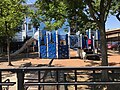 Kayem Park
 -
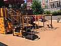 Dever Park
 -
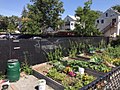 Anita's Garden
 -
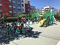 Judie Dyer Park
 -
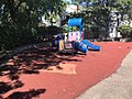 Eden Street Park
 -
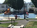 Bellingham Park
 -
 Port Park
 -
 Ciepela Memorial Park
 -
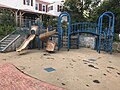 O'Neil Park
 -
 Mystic River Overlook Park & Dog Park
 -
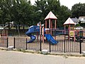 Carter Park
 -
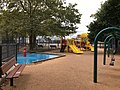 Voke Park


Notable people
[edit]- Horatio Alger, author
- Miguel La Fay Bardi, Roman Catholic Prelate of the Territorial Prelature of Sicuani (1999–2013)[72]
- Richard Bellingham, governor of the Massachusetts Bay Colony
- Tom Birmingham, former President of the Massachusetts Senate
- Selma Botman, President of the University of Southern Maine
- Ian Bremmer, political scientist and founder of Eurasia Group
- Alfred Winsor Brown, 31st Naval Governor of Guam
- William Bryden, U.S. Army major general[73]
- Vannevar Bush, Raytheon Company Co-founder
- Chick Corea, jazz musician
- Norman Cota, United States Army general
- Albert DeSalvo, Boston Strangler
- Win Elliot, sportscaster and game show host
- Anna Christy Fall (1855–1930), lawyer
- David Sidney Feingold, biochemist, born in Chelsea in 1922
- Jack Harvey, member of the Wisconsin State Assembly
- Ray Hyman, Professor Emeritus of Psychology at the University of Oregon, author, magician and a noted critic of parapsychology
- Brian Kelly, LSU Tigers head football coach
- Isaac Pendleton Langworthy, American Congregational minister and librarian
- Lewis Howard Latimer, scientist and inventor
- Samuel Maverick, colonist
- Howard B. Meek, educator at Cornell University
- Charles E. Mitchell, banker
- Jim Mutrie, baseball pioneer
- Joseph C. O'Mahoney, United States Senator from Wyoming
- Marion Osgood, violinist, orchestra leader, composer
- Daniel Pratt, author and eccentric
- Belle Yeaton Renfrew, trombonist and conductor
- Harris S. Richardson, former President of the Massachusetts Senate
- Annette Rogers, sprinter and Olympic gold medalist
- John Ruiz, heavyweight boxing champion
- Joe Smith (music industry executive)
- Arnold Stang, actor, known for films such as The Man with the Golden Arm and It's a Mad, Mad, Mad, Mad World
- Elizabeth Cady Stanton, American social activist, abolitionist, and leading figure of the early women's rights movement
- Michelle Tea, author, poet, and literary arts organizer, co-founder of lesbian-feminist performance art collective based in San Francisco
- Carl Voss, National Hockey League Hall of Famer
- Wenepoykin, last sachem of the Naumkeag people
- John Raimondi, renowned American sculptor and art collector.
See also
[edit]References
[edit]- ^ "2020 U.S. Gazetteer Files". United States Census Bureau. Retrieved May 21, 2022.
- ^ "U.S. Census Bureau QuickFacts: Chelsea city, Massachusetts". United States Census Bureau. Retrieved September 15, 2021.
- ^ "U.S. Census Bureau QuickFacts: Chelsea city, Massachusetts". Census Bureau QuickFacts. Archived from the original on May 1, 2018. Retrieved September 15, 2021.
- ^ "Geographic Identifiers: 2010 Demographic Profile Data (G001): Chelsea city, Massachusetts". United States Census Bureau. Retrieved July 3, 2012.
- ^ Douglas-Lithgow, R. A. (1909). Dictionary of American Indian Place and Proper Names in New England. Salem MA: Salem Press. p. 179.
- ^ Wright, Carroll D. (1889). Report on the Custody and Condition of the Public Records of Parishes, Towns, and Counties. Boston: Wright & Potter Printing Company, State Printers. Retrieved August 19, 2015.
- ^ a b Margaret Harriman Clarke (2004). Chelsea in the 20th Century. Arcadia Publishing. pp. 29–, 85–. ISBN 978-0-7385-3628-6.
- ^ Levine, Yitzchok (August 20, 2004). "Harav Avigdor Miller's First Rabbanus: The Walnut Street Shul" (PDF). The Hamodia Magazine. Archived (PDF) from the original on August 15, 2014. Retrieved December 13, 2013.
- ^ Conti, Katheleen (April 10, 2008). "When Chelsea burned". boston.com. The Boston Globe. Archived from the original on December 14, 2013. Retrieved December 13, 2013.
- ^ Hanson, Melissa (October 14, 2013). "Chelsea recalls 1973 blaze that destroyed 18 blocks". bostonglobe.com. The Boston Globe. Archived from the original on December 14, 2013. Retrieved December 13, 2013.
- ^ Bailou, Brian (November 26, 2007). "From industrial to desirable: rebuilding Chelsea". boston.com. Archived from the original on December 14, 2013. Retrieved December 13, 2013.
- ^ McMorrow, Paul (February 12, 2013). "Chelsea reclaims its waterfront". bostonglobe.com. The Boston Globe. Archived from the original on December 14, 2013. Retrieved December 13, 2013.
- ^ "U.S. Census Bureau QuickFacts: United States". Census.gov. Retrieved September 15, 2021.
- ^ "City and Town Population Totals: 2020−2022". United States Census Bureau. Retrieved November 25, 2023.
- ^ "U.S. Census website". United States Census Bureau. Retrieved January 31, 2008.
- ^ Demographics of the United States
- ^ City of Chelsea. "City of Chelsea Fair Housing Plan" (PDF). Metropolitan Area Planning Council. Retrieved May 30, 2024.
- ^ "American FactFinder - Results". Archived from the original on December 18, 2014. Retrieved May 7, 2016.
- ^ Bureau, U.S. Census. "U.S. Census website". United States Census Bureau. Retrieved May 1, 2018.
{{cite web}}:|last=has generic name (help) - ^ Sacchetti, Maria. "A melting pot stretches out to the suburbs." Boston Globe. September 15, 2010. p. 1 (Archive). Retrieved on September 23, 2014.
- ^ "Archived copy" (PDF). Archived (PDF) from the original on July 22, 2017. Retrieved August 2, 2017.
{{cite web}}: CS1 maint: archived copy as title (link) - ^ Galvin, William. "Public Document 43". electionstats.state.ma.us.
- ^ "Election statistics, the Commonwealth of Massachusetts".
- ^ "Election statistics, the Commonwealth of Massachusetts". 1964.
- ^ "Election statistics, the Commonwealth of Massachusetts".
- ^ "Election statistics, the Commonwealth of Massachusetts". 1956.
- ^ "Election statistics, the Commonwealth of Massachusetts". 1952.
- ^ "Election statistics".
- ^ "Election statistics".
- ^ "Election statistics".
- ^ "Election statistics".
- ^ "Election statistics".
- ^ "A manual for the use of the General Court (1929)". December 30, 1929. hdl:2452/40703. Archived from the original on July 27, 2020. Retrieved July 18, 2024 – via archives.lib.state.ma.us.
- ^ "A manual for the use of the General Court (1925)". December 30, 1925. hdl:2452/40701. Archived from the original on July 27, 2020. Retrieved July 18, 2024 – via archives.lib.state.ma.us.
- ^ "A manual for the use of the General Court (1921)". December 30, 1921. hdl:2452/40699. Archived from the original on May 19, 2020. Retrieved July 18, 2024 – via archives.lib.state.ma.us.
- ^ "A manual for the use of the General Court (1917)". December 30, 1917. hdl:2452/40695. Archived from the original on May 19, 2020. Retrieved July 18, 2024 – via archives.lib.state.ma.us.
- ^ "A manual for the use of the General Court (1913)". December 30, 1913. hdl:2452/40691. Archived from the original on July 27, 2020. Retrieved July 18, 2024 – via archives.lib.state.ma.us.
- ^ "A manual for the use of the General Court (1909)". December 30, 1909. hdl:2452/40687. Archived from the original on May 19, 2020. Retrieved July 18, 2024 – via archives.lib.state.ma.us.
- ^ "A manual for the use of the General Court (1905)". December 30, 1905. hdl:2452/40683. Archived from the original on May 19, 2020. Retrieved July 18, 2024 – via archives.lib.state.ma.us.
- ^ "A manual for the use of the General Court (1901)". December 30, 1901. hdl:2452/40679. Archived from the original on May 19, 2020. Retrieved July 18, 2024 – via archives.lib.state.ma.us.
- ^ "A manual for the use of the General Court (1897)". December 30, 1897. hdl:2452/40675. Archived from the original on May 19, 2020. Retrieved July 18, 2024 – via archives.lib.state.ma.us.
- ^ "A manual for the use of the General Court (1893)". December 30, 1893. hdl:2452/40671. Archived from the original on May 19, 2020. Retrieved July 18, 2024 – via archives.lib.state.ma.us.
- ^ "A manual for the use of the General Court (1889)". December 30, 1889. hdl:2452/40667. Archived from the original on May 19, 2020. Retrieved July 18, 2024 – via archives.lib.state.ma.us.
- ^ "A manual for the use of the General Court (1885)". December 30, 1885. hdl:2452/40663. Archived from the original on May 19, 2020. Retrieved July 18, 2024 – via archives.lib.state.ma.us.
- ^ "A manual for the use of the General Court (1881)". December 30, 1881. hdl:2452/40659. Archived from the original on May 19, 2020. Retrieved July 18, 2024 – via archives.lib.state.ma.us.
- ^ "A manual for the use of the General Court (1877)". December 30, 1877. hdl:2452/40655. Archived from the original on May 19, 2020. Retrieved July 18, 2024 – via archives.lib.state.ma.us.
- ^ "A manual for the use of the General Court (1873)". December 30, 1873. hdl:2452/40651. Archived from the original on May 19, 2020. Retrieved July 18, 2024 – via archives.lib.state.ma.us.
- ^ "A manual for the use of the General Court (1869)". December 30, 1869. hdl:2452/40647. Archived from the original on May 19, 2020. Retrieved July 18, 2024 – via archives.lib.state.ma.us.
- ^ "City of Chelsea CAFR" (PDF). chelseama.gov. Archived from the original (PDF) on January 12, 2016. Retrieved May 1, 2018.
- ^ "Split Decision:50/50 Night for Reimagining Broadway as Council Wrestles with Legalities – Chelsea Record".
- ^ a b "Baker-Polito Administration Expands Transformative Development Initiative For Gateway Cities". mass.gov. July 23, 2019. Archived from the original on July 26, 2019.
- ^ "Projects".
- ^ "User account | City of Chelsea MA".
- ^ "Archived copy" (PDF). Archived (PDF) from the original on August 24, 2017. Retrieved August 23, 2017.
{{cite web}}: CS1 maint: archived copy as title (link) - ^ "Meet Google Drive – One place for all your files".
- ^ "Archived copy" (PDF). Archived (PDF) from the original on August 24, 2017. Retrieved August 23, 2017.
{{cite web}}: CS1 maint: archived copy as title (link) - ^ "Chelsea Restoration Corporation | Home Services". Archived from the original on August 24, 2017. Retrieved August 23, 2017.
- ^ "Re-imagining Broadway: Final Report" (PDF). City of Chelsea, Massachusetts. June 2018. Archived from the original (PDF) on April 26, 2019. Retrieved April 26, 2019.
- ^ "Re-Imagining Broadway- Community Workshop | City of Chelsea MA". www.chelseama.gov. Retrieved April 26, 2019.
- ^ "About the City of Chelsea". chelseama.gov. City of Chelsea. Archived from the original on December 14, 2013. Retrieved December 13, 2013.
- ^ Authority, Massachusetts Bay Transportation. "New Silver Line 3-Chelsea Service between Chelsea and South Station | News | MBTA". www.mbta.com. Archived from the original on March 16, 2018. Retrieved March 24, 2018.
- ^ Fox, Jeremy C. (November 28, 2012). "Martin A. Coughlin Bypass Road opens to route commercial traffic off East Boston streets". Boston Globe. Archived from the original on August 15, 2014. Retrieved May 6, 2013.
- ^ State House News Surface (October 30, 2013). "More details announced on Silver Line expansion to Chelsea". Boston Globe. Archived from the original on November 2, 2013. Retrieved November 4, 2013.
- ^ Guzman, Dan (October 30, 2013). "MBTA To Extend Silver Line To East Boston, Chelsea". 90.9 WBUR. Archived from the original on November 5, 2013. Retrieved November 4, 2013.
- ^ "Governor Patrick Announces MBTA Silver Line Expansion". Commonwealth Conversations: Transportation. Massachusetts Department of Transportation. October 30, 2013. Archived from the original on November 5, 2013. Retrieved November 4, 2013.
- ^ State House News Surface (October 30, 2013). "More details announced on Silver Line expansion to Chelsea". Boston Globe. Archived from the original on November 2, 2013. Retrieved December 13, 2013.
- ^ Matrix Consulting Group, Performance and Management Study of the Fire Department, Chelsea, Massachusetts. November, 2012, p. 48.
- ^ "Quatieri the Choice as Next Fire Chief – Chelsea Record".
- ^ "Cataldo Ambulance Sees Drop in Overall Calls But More Potential COVID-19 Patients". Retrieved May 23, 2023.
- ^ "Cataldo Ambulance Service Inc. v. Chelsea". Retrieved May 23, 2023.
- ^ Seth Daniel, "Chelsea Clock Company Making Move to Second St. After 117 Years on Everett Ave." Archived 2016-03-07 at the Wayback Machine, Chelsea Record, May 7, 2015. Retrieved February 22, 2016.
- ^ "Bishop Miguel La Fay Bardi O. Carm". Order of the Carmelites. Archived from the original on August 24, 2012. Retrieved November 21, 2021.
- ^ "No. 1 In a Class of 78: William Bryden of Chelsea Appointed to Cadetship at West Point". The Boston Globe. Boston, MA. July 24, 1900. p. 2 – via Newspapers.com.
Further reading
[edit]- Chamberlain, Mellen (1908). A documentary history of Chelsea: including the Boston precincts of Winnisimmet, Rumney Marsh, and Pullen Point, 1624–1824. Boston: Massachusetts Historical Society.
- Rezendes, Michael (September 1, 1981). "The city that wouldn't die: The rise and fall and rise of Chelsea". The Boston Phoenix. Retrieved April 15, 2024.
External links
[edit]Municipalities and communities of Suffolk County, Massachusetts, United States | ||
|---|---|---|
| Cities |  | |
| Neighborhoods | ||
| International | |
|---|---|
| National | |
| Geographic | |
| Other | |
- Chelsea, Massachusetts
- 1620s establishments in the Massachusetts Bay Colony
- 1624 establishments in the Thirteen Colonies
- Cities in Massachusetts
- Cities in Suffolk County, Massachusetts
- Hispanic and Latino American culture in Massachusetts
- Historic Jewish communities in the United States
- Populated coastal places in Massachusetts
- Populated places established in 1624
- Russian communities in the United States