
Kobar: Difference between revisions
→History: ce |
→Bibliography: |first2=K. | last2=Abdulfattah |author-link2=Kamal Abdulfattah |
||
| (32 intermediate revisions by 21 users not shown) | |||
| Line 1: | Line 1: | ||
{{Infobox |
{{Infobox settlement |
||
|name |
| name = Kobar |
||
| translit_lang1 = Arabic |
|||
|arname=كوبر |
|||
| translit_lang1_type = [[Arabic script|Arabic]] |
|||
|altOffSp=Kaubar |
|||
| translit_lang1_info = {{lang|ar|كوبر}} |
|||
| ⚫ | |||
| translit_lang1_type1 = [[Latin script|Latin]] |
|||
| ⚫ | |||
| translit_lang1_info1 = Kaubar (official) |
|||
| ⚫ | |||
| ⚫ | |||
| ⚫ | |||
| ⚫ | |||
| ⚫ | |||
| ⚫ | |||
| ⚫ | |||
| ⚫ | |||
| ⚫ | |||
| image_blank_emblem = |
|||
|coordinates_region = IL |
|||
| blank_emblem_type = |
|||
| ⚫ | |||
| blank_emblem_size = |
|||
| ⚫ | |||
| ⚫ | |||
| ⚫ | |||
| ⚫ | |||
| ⚫ | |||
| ⚫ | |||
|governorate=rb |
|||
| image_map = |
|||
<!-- Area---------------------> |
|||
| |
| mapsize = |
||
| map_caption = |
|||
|unit_pref = <!--Enter: Imperial, if Imperial (metric) is desired--> |
|||
| ⚫ | |||
| ⚫ | |||
| grid_name = [[Palestine grid|Palestine grid]] |
|||
| ⚫ | |||
| grid_position = 165/155 |
|||
<!-- Population -----------------------> |
|||
| ⚫ | |||
| ⚫ | |||
| ⚫ | |||
| ⚫ | |||
| ⚫ | |||
<!-- other info ---------------> |
|||
| ⚫ | |||
| ⚫ | |||
| established_title = Founded |
|||
| ⚫ | |||
| established_date = |
|||
| ⚫ | |||
| government_footnotes = <!-- for references: use <ref> tags --> |
|||
|palgrid=165/155 |
|||
| government_type = |
|||
| ⚫ | |||
| |
| leader_title = |
||
| |
| leader_name = |
||
| unit_pref = dunam |
|||
| ⚫ | |||
| ⚫ | |||
| area_total_dunam = |
|||
| ⚫ | |||
| elevation_m = 670 |
|||
| elevation_min_m = |
|||
| elevation_max_m = |
|||
| population_footnotes = <ref name="PrelimCensus2017">{{cite report |date=February 2018 |title=Preliminary Results of the Population, Housing and Establishments Census, 2017 |url=https://www.pcbs.gov.ps/Downloads/book2364-1.pdf |department=[[Palestinian Central Bureau of Statistics]] (PCBS) |publisher=[[State of Palestine]] |pages=64–82 |access-date=2023-10-24}}</ref> |
|||
| ⚫ | |||
| ⚫ | |||
| population_note = |
|||
| population_density_km2 = |
|||
| blank_name_sec1 = Name meaning |
|||
| ⚫ | |||
| ⚫ | |||
| footnotes = |
|||
}} |
}} |
||
'''Kobar''' ({{lang-ar|كوبر}}) is a [[Palestinian people|Palestinian]] village in the [[Ramallah and al-Bireh Governorate]] in the northern [[West Bank]]. Kobar is located at an altitude of {{convert|670|m|ft|sp=us}} above [[sea level]] with a mean annual [[rainfall]] of 669.8 mm. The average annual [[temperature]] is 16 |
'''Kobar''' ({{lang-ar|كوبر}}) is a [[Palestinian people|Palestinian]] village in the [[Ramallah and al-Bireh Governorate]] in the northern [[West Bank]]. Kobar is located at an altitude of {{convert|670|m|ft|sp=us}} above [[sea level]] with a mean annual [[rainfall]] of 669.8 mm. The average annual [[temperature]] is 16 °C and the average annual [[humidity]] is approximately 61%. |
||
Since 1996, Kobar has been governed by a [[Village council (Palestinian Authority)|village council]] which is currently administrated by 11 members appointed by the [[Palestinian National Authority]]. There are two further employees working in the council; the village council owns a permanent headquarters and is included within a Joint Services Council for neighboring localities. |
Since 1996, Kobar has been governed by a [[Village council (Palestinian Authority)|village council]] which is currently administrated by 11 members appointed by the [[Palestinian National Authority]]. There are two further employees working in the council; the village council owns a permanent headquarters and is included within a Joint Services Council for neighboring localities. |
||
== Location == |
== Location == |
||
Kobar located {{convert|10.1|km|mi|sp=us}} north of [[Ramallah]]. It is bordered by [[Burham, Ramallah|Burham]] |
Kobar located {{convert|10.1|km|mi|sp=us}} north of [[Ramallah]]. It is bordered by [[Burham, Ramallah|Burham]] to the east, [[Jibiya, Ramallah|Jibiya]] and [[Umm Safa]] to the north, [[Al-Ittihad, Ramallah|al-Ittihad]] to the west, and [[al-Zaitounah]] and [[Bir Zeit]] to the south.<ref name=ARIJp4>[http://vprofile.arij.org/ramallah/pdfs/vprofile/Kobar_vp_En.pdf Kobar Village Profile], ARIJ, p. 4</ref> |
||
== History == |
== History == |
||
According to the Kobar Village Council, the name "Kobar" means "the place where the [[gypsum]] was" on account of it once containing abundant gypsum deposits.<ref>[http://vprofile.arij.org/ramallah/pdfs/vprofile/Kobar_vp_En.pdf Kobar Village Profile], Applied Research Institute - Jerusalem (ARIJ). 2012.</ref> |
According to the Kobar Village Council, the name "Kobar" means "the place where the [[gypsum]] was" on account of it once containing abundant gypsum deposits.<ref>[http://vprofile.arij.org/ramallah/pdfs/vprofile/Kobar_vp_En.pdf Kobar Village Profile], Applied Research Institute - Jerusalem (ARIJ). 2012.</ref> |
||
[[Sherd|Potsherd]]s from the |
[[Sherd|Potsherd]]s from the [[Ancient Near East#Iron Age|Iron Age]], [[Achaemenid Empire|Persian]]/[[Hellenistic period|Hellenistic]], [[Byzantine Empire|Byzantine]], [[Crusader states|Crusader]]/[[Ayyubid dynasty|Ayyubid]] and [[Mamluk Sultanate (Cairo)|Mamluk]] periods have been found in the village. The oldest sherds were found on the north and south slopes of the village, while Byzantine sherds were found on the west side.<ref name=Finkelstein>Finkelstein et al, 1997, pp. 397-398</ref> |
||
===Ottoman era=== |
===Ottoman era=== |
||
Kobar |
Kobar was incorporated into the [[Ottoman Empire]] in 1517, and in the [[Defter|census]] of 1596, the village was located in the ''[[Nahiya]]'' of Quds of the ''[[Liwa (Arabic)|Liwa]]'' of [[Al-Quds|Quds]]. The population was 31 households, all [[Muslim]]. They paid a fixed tax-rate of 33,3% on wheat, barley, vineyards, fruit trees, occasional revenues, goats and/or beehives; a total of 4,000 [[akçe]].<ref>Hütteroth and Abdulfattah, 1977, p. 116</ref> Potsherds from the early Ottoman period has also been found here.<ref name=Finkelstein/> |
||
In 1838, it was noted as ''Kubar'', a Muslim village in the ''Bani Zeid'' district, north of Jerusalem.<ref name=Robinson125>Robinson and Smith, 1841, vol 3, Appendix 2, p. |
In 1838, it was noted as ''Kubar'', a Muslim village in the ''Bani Zeid'' district, north of Jerusalem.<ref name=Robinson125>Robinson and Smith, 1841, vol 3, Appendix 2, p. [https://archive.org/stream/biblicalresearch03robiuoft#page/125/mode/1up 125]</ref> |
||
In 1863 the French explorer [[Victor Guérin]] visited the village. He noted it had 600 inhabitants, and a |
In 1863 the French explorer [[Victor Guérin]] visited the village. He noted it had 600 inhabitants, and a [[mosque]] dedicated to a [[Sheikh]] Ahmed.<ref>Guérin, 1869, p. [https://archive.org/stream/descriptiongogr06gugoog#page/n49/mode/1up 36]</ref> An Ottoman village list of about 1870 showed ''Kobar'' with a population of 220, in 48 houses, though the population count included men, only.<ref>Socin, 1879, p. [https://archive.org/stream/zeitschriftdesde01deut#page/156/mode/1up 156] It was also noted to be in the ''Bani Zeid'' district</ref><ref>Hartmann, 1883, p. [https://archive.org/stream/bub_gb_BZobAQAAIAAJ#page/n914/mode/1up 106], noted 51 houses</ref> |
||
In 1882, the [[Palestine Exploration Fund]]'s ''Survey of Western Palestine'' described Kobar as a "small village on a hill-top, with rock-cut tombs, and a tank, surrounded by olives."<ref>Conder and Kitchener, 1882, SWP II, p. [https://archive.org/stream/surveyofwesternp02conduoft#page/290/mode/1up 290]</ref> |
In 1882, the [[Palestine Exploration Fund|PEF]]'s ''[[PEF Survey of Palestine|Survey of Western Palestine]]'' (SWP) described Kobar as a "small village on a hill-top, with rock-cut tombs, and a tank, surrounded by olives."<ref>Conder and Kitchener, 1882, SWP II, p. [https://archive.org/stream/surveyofwesternp02conduoft#page/290/mode/1up 290]</ref> |
||
| ⚫ | |||
| ⚫ | |||
===British Mandate era=== |
===British Mandate era=== |
||
In the [[1922 census of Palestine]] conducted by the [[Mandatory Palestine|British Mandate authorities]], Kubar had a population of 447; 444 Muslims and 3 Christians<ref name=Census1922>Barron, 1923, |
In the [[1922 census of Palestine]] conducted by the [[Mandatory Palestine|British Mandate authorities]], Kubar had a population of 447; 444 Muslims and 3 Christians<ref name=Census1922>Barron, 1923, Table VII, Sub-district of Ramallah, p. [https://archive.org/stream/PalestineCensus1922/Palestine%20Census%20%281922%29#page/n18/mode/1up 16]</ref> where the Christians were all Orthodox.<ref name=Census1922b>Barron, 1923, Table XIV, p. [https://archive.org/stream/PalestineCensus1922/Palestine%20Census%20%281922%29#page/n47/mode/1up 45]</ref> This had increased by the time of the [[1931 census of Palestine|1931 census]] to 546, all Muslim, in 122 houses.<ref name="Census1931">Mills, 1932, p. [https://archive.org/details/CensusOfPalestine1931.PopulationOfVillagesTownsAndAdministrativeAreas 49].</ref> |
||
In 1922, [[Tawfiq Canaan]] documented local traditions linking two springs to spirits. 'En el-Qubbeh was believed to be the dwelling place of es-sitt Zenab, who reportedly inflicted consequences on any unclean woman approaching the spring, resulting in permanent loss of menstruation or the death of one of her children. Another spring, 'en esh-Sharqiyeh, was said to be home to es-sitt Fattumeh, who was observed engaging in prayer at the site.<ref>{{Cite book |last=Canaan |first=Tawfiq |title=Studies in Palestinian Customs and Folklore |publisher=The Palestine Oriental Society |year=1922 |location=Jerusalem |pages=20 |chapter=II: Haunted Springs and Water Demons in Palestine}}</ref> |
|||
In the [[Village Statistics, 1945|1945 statistics]] the population was 610, all Muslims,<ref name=1945p26>Government of Palestine, Department of Statistics, 1945, p. [http://users.cecs.anu.edu.au/~bdm/yabber/census/VSpages/VS1945_p26.jpg 26]</ref> while the total land area was 9,678 [[dunam]]s, according to an official land and population survey.<ref>Government of Palestine, Department of Statistics. ''Village Statistics, April, 1945.'' Quoted in Hadawi, |
In the [[Village Statistics, 1945|1945 statistics]] the population was 610, all Muslims,<ref name=1945p26>Government of Palestine, Department of Statistics, 1945, p. [http://users.cecs.anu.edu.au/~bdm/yabber/census/VSpages/VS1945_p26.jpg 26]</ref> while the total land area was 9,678 [[dunam]]s, according to an official land and population survey.<ref>Government of Palestine, Department of Statistics. ''Village Statistics, April, 1945.'' Quoted in Hadawi, 1970, p. [http://www.palestineremembered.com/download/VillageStatistics/Table%20I/Ramallah/Page-065.jpg 65]</ref> Of this, 3,512 were allocated for plantations and irrigable land, 1,434 for cereals,<ref>Government of Palestine, Department of Statistics. ''Village Statistics, April, 1945.'' Quoted in Hadawi, 1970, p. [http://www.palestineremembered.com/download/VillageStatistics/Table%20II/Ramallah/Page-112.jpg 112]</ref> while 33 dunams were classified as built-up areas.<ref>Government of Palestine, Department of Statistics. ''Village Statistics, April, 1945.'' Quoted in Hadawi, 1970, p. [http://www.palestineremembered.com/download/VillageStatistics/Table%20III/Ramallah/Page-162.jpg 162]</ref> |
||
===Jordanian era=== |
===Jordanian era=== |
||
In the wake of the [[1948 Arab–Israeli War]], and after the [[1949 Armistice Agreements]], |
In the wake of the [[1948 Arab–Israeli War]], and after the [[1949 Armistice Agreements]], Kobar was occupied by Jordan and subsequently annexed by Jordan. |
||
The Jordanian census of 1961 found 934 inhabitants in ''Kaubar''.<ref>Government of Jordan, 1964, p. [http://users.cecs.anu.edu.au/~bdm/yabber/census/JordanCensusPages/JordanCensus1961-p24.pdf 24]</ref> |
The Jordanian census of 1961 found 934 inhabitants in ''Kaubar''.<ref>Government of Jordan, 1964, p. [http://users.cecs.anu.edu.au/~bdm/yabber/census/JordanCensusPages/JordanCensus1961-p24.pdf 24]</ref> |
||
===1967-present=== |
===1967-present=== |
||
Since the [[Six-Day War]] in 1967, Kobar has been under [[Israeli occupation of the West Bank|Israeli occupation]]. |
|||
After the [[Oslo II Accord|1995 accords]], 53.7 |
After the [[Oslo II Accord|1995 accords]], 53.7% of village land belongs to [[Palestinian enclaves|Area B]], while the remaining 46.3% is [[Area C (West Bank)|Area C]].<ref>[http://vprofile.arij.org/ramallah/pdfs/vprofile/Kobar_vp_En.pdf Kobar Village Profile], ARIJ, p. 17</ref> |
||
In 2008, the preacher at the local mosque in Kobar, Majed Barghouti, 44, died while in detention. His relatives alleged that he had been tortured.<ref>[http://www.haaretz.com/news/hamas-preacher-dies-while-in-palestinian-jail-kin-allege-torture-1.239948 Hamas preacher dies while in Palestinian jail; kin allege torture], Feb. 23, 2008, [[Haaretz]]</ref><ref>[http://www.haaretz.com/print-edition/news/hamas-turns-west-bank-funeral-of-leading-cleric-into-protest-against-fatah-1.240071 Hamas turns West Bank funeral of leading cleric into protest against Fatah], Feb. 25, 2008, Haaretz</ref> |
In 2008, the preacher at the local mosque in Kobar, Majed Barghouti, 44, died while in detention. His relatives alleged that he had been tortured.<ref>[http://www.haaretz.com/news/hamas-preacher-dies-while-in-palestinian-jail-kin-allege-torture-1.239948 Hamas preacher dies while in Palestinian jail; kin allege torture], Feb. 23, 2008, [[Haaretz]]</ref><ref>[http://www.haaretz.com/print-edition/news/hamas-turns-west-bank-funeral-of-leading-cleric-into-protest-against-fatah-1.240071 Hamas turns West Bank funeral of leading cleric into protest against Fatah], Feb. 25, 2008, Haaretz</ref> |
||
==Notable people from Kobar== |
==Notable people from Kobar== |
||
*[[Fadwa Barghouti]] |
|||
*[[Marwan Barghouti]] |
*[[Marwan Barghouti]] |
||
*[[Hussein Barghouthi]] (1954 – 2002) |
*[[Hussein Barghouthi]] (1954 – 2002) |
||
== Twin towns == |
== Twin towns == |
||
*{{flagicon|Great Britain}} |
*{{flagicon|Great Britain}} [[Walsall, United Kingdom]]<ref>[https://www.walsallkobar.org.uk/About%20Kobar.html Walsall - Kobar Friendship Group]</ref> |
||
==References== |
==References== |
||
| Line 83: | Line 106: | ||
==Bibliography== |
==Bibliography== |
||
{{refbegin}} |
{{refbegin}} |
||
*{{cite book | editor =Barron, |
*{{cite book | editor =Barron, J. B. | title = Palestine: Report and General Abstracts of the Census of 1922|url=https://archive.org/details/PalestineCensus1922 | publisher = Government of Palestine | year = 1923}} |
||
*{{cite book|last1=Conder|first1=C.R.| |
*{{cite book|last1=Conder|first1=C.R.|author-link1=Claude Reignier Conder|last2=Kitchener|first2=H.H.|author-link2=Herbert Kitchener, 1st Earl Kitchener|year=1882|url=https://archive.org/details/surveyofwesternp02conduoft|title=The Survey of Western Palestine: Memoirs of the Topography, Orography, Hydrography, and Archaeology|location=London|publisher=[[Palestine Exploration Fund|Committee of the Palestine Exploration Fund]]|volume=2}} |
||
*{{cite book|editor1=Finkelstein, I. | editor1-link= Israel Finkelstein|editor2=Lederman, Zvi|year=1997|title=Highlands of many cultures|url=https://books.google. |
*{{cite book|editor1=Finkelstein, I. | editor1-link= Israel Finkelstein|editor2=Lederman, Zvi|year=1997|title=Highlands of many cultures|url=https://books.google.com/books?id=hA59tgAACAAJ |location=[[Tel Aviv]]|publisher= Institute of Archaeology of Tel Aviv University Publications Section| isbn = 965-440-007-3}} |
||
*{{cite book | title = First Census of Population and Housing. Volume I: Final Tables; General Characteristics of the Population | author = Government of Jordan, Department of Statistics | year = 1964|url=http://cs.anu.edu.au/~bdm/yabber/census/JordanCensus1961bits.pdf}} |
*{{cite book | title = First Census of Population and Housing. Volume I: Final Tables; General Characteristics of the Population | author = Government of Jordan, Department of Statistics | year = 1964|url=http://cs.anu.edu.au/~bdm/yabber/census/JordanCensus1961bits.pdf}} |
||
*{{cite book|title=Village Statistics, April, 1945 |url=http://web.nli.org.il/sites/nli/Hebrew/library/Pages/BookReader.aspx?pid=856390|author=Government of Palestine, Department of Statistics|year=1945 |
*{{cite book|title=Village Statistics, April, 1945 |url=http://web.nli.org.il/sites/nli/Hebrew/library/Pages/BookReader.aspx?pid=856390|author=Government of Palestine, Department of Statistics|year=1945}} |
||
*{{cite book|last=Guérin|first=V.| |
*{{cite book|last=Guérin|first=V.|author-link=Victor Guérin|title=Description Géographique Historique et Archéologique de la Palestine|url=https://archive.org/details/descriptiongogr06gugoog|volume=1: Judee, pt. 3|year=1869|publisher= L'Imprimerie Nationale|location=Paris|language=fr}} |
||
*{{cite book|title=Village Statistics of 1945: A Classification of Land and Area ownership in Palestine|url=http://www.palestineremembered.com/Articles/General-2/Story3150.html|first=S.|last=Hadawi| |
*{{cite book|title=Village Statistics of 1945: A Classification of Land and Area ownership in Palestine|url=http://www.palestineremembered.com/Articles/General-2/Story3150.html|first=S.|last=Hadawi|author-link=Sami Hadawi|year=1970|publisher=Palestine Liberation Organization Research Center}} |
||
*{{cite journal | last = Hartmann | first =M.| |
*{{cite journal | last = Hartmann | first =M.| author-link = Martin Hartmann | title = Die Ortschaftenliste des Liwa Jerusalem in dem türkischen Staatskalender für Syrien auf das Jahr 1288 der Flucht (1871) | journal = Zeitschrift des Deutschen Palästina-Vereins | volume = 6 | pages = 102–149 | url =https://archive.org/details/bub_gb_BZobAQAAIAAJ | year = 1883}} |
||
*{{cite book | last1= Hütteroth |
*{{cite book | last1= Hütteroth|first1=W.-D.|author-link1=Wolf-Dieter Hütteroth |first2=K. | last2=Abdulfattah |author-link2=Kamal Abdulfattah| title = Historical Geography of Palestine, Transjordan and Southern Syria in the Late 16th Century |url= https://books.google.com/books?id=wqULAAAAIAAJ | year = 1977 | publisher = Erlanger Geographische Arbeiten, Sonderband 5. Erlangen, Germany: Vorstand der Fränkischen Geographischen Gesellschaft|isbn= 3-920405-41-2}} |
||
*{{cite book | editor = Mills, E. | title = Census of Palestine 1931. Population of Villages, Towns and Administrative Areas |url=https://archive.org/details/CensusOfPalestine1931.PopulationOfVillagesTownsAndAdministrativeAreas | publisher = Government of Palestine | location = Jerusalem | year = 1932}} |
*{{cite book | editor = Mills, E. | title = Census of Palestine 1931. Population of Villages, Towns and Administrative Areas |url=https://archive.org/details/CensusOfPalestine1931.PopulationOfVillagesTownsAndAdministrativeAreas | publisher = Government of Palestine | location = Jerusalem | year = 1932}} |
||
*{{cite book|last=Palmer|first=E.H.| |
*{{cite book|last=Palmer|first=E.H.|author-link=Edward Henry Palmer|year=1881|url=https://archive.org/details/surveyofwesternp00conduoft|title=The Survey of Western Palestine: Arabic and English Name Lists Collected During the Survey by Lieutenants Conder and Kitchener, R. E. Transliterated and Explained by E.H. Palmer|publisher=[[Palestine Exploration Fund|Committee of the Palestine Exploration Fund]]}} |
||
*{{cite book|last1=Robinson|first1=E.| |
*{{cite book|last1=Robinson|first1=E.|author-link1=Edward Robinson (scholar)|last2=Smith|first2=E.|author-link2=Eli Smith|year=1841|url=https://archive.org/details/biblicalresearch03robiuoft |title=Biblical Researches in Palestine, Mount Sinai and Arabia Petraea: A Journal of Travels in the year 1838| location=Boston|publisher=[[Crocker & Brewster]]|volume=3}} |
||
*{{cite journal | last = Schick | first =C.| |
*{{cite journal | last = Schick | first =C.| author-link = Conrad Schick | title = Zur Einwohnerzahl des Bezirks Jerusalem | journal = Zeitschrift des Deutschen Palästina-Vereins | volume = 19 | pages = 120–127 | url =https://archive.org/details/zeitschriftdesde19deut | year = 1896}} |
||
*{{cite journal | author = Socin, A.| |
*{{cite journal | author = Socin, A.| author-link = Albert Socin | title = Alphabetisches Verzeichniss von Ortschaften des Paschalik Jerusalem | journal = Zeitschrift des Deutschen Palästina-Vereins | volume = 2 | pages = 135–163 | url = https://archive.org/details/zeitschriftdesde01deut | year = 1879}} |
||
{{refend}} |
{{refend}} |
||
==External links== |
==External links== |
||
* [http://www.palestineremembered.com/GeoPoints/Kaubar_1284/index.html Welcome To Kaubar] |
* [http://www.palestineremembered.com/GeoPoints/Kaubar_1284/index.html Welcome To Kaubar] |
||
* Survey of Western Palestine, Map 14: |
* Survey of Western Palestine, Map 14: [https://web.archive.org/web/20180928072721/http://www.iaa-archives.org.il/zoom/zoom.aspx?folder_id=93&type_id=6&id=8376 IAA], [http://commons.wikimedia.org/wiki/File:Survey_of_Western_Palestine_1880.14.jpg Wikimedia commons] |
||
* [http://vprofile.arij.org/ramallah/pdfs/factsheet/Kobar_vp_en.pdf Kobar Village (Fact Sheet)], |
* [http://vprofile.arij.org/ramallah/pdfs/factsheet/Kobar_vp_en.pdf Kobar Village (Fact Sheet)], [[Applied Research Institute–Jerusalem]] (ARIJ) |
||
* [http://vprofile.arij.org/ramallah/pdfs/vprofile/Kobar_vp_En.pdf Kobar Village Profile], |
* [http://vprofile.arij.org/ramallah/pdfs/vprofile/Kobar_vp_En.pdf Kobar Village Profile], ARIJ |
||
* [http://vprofile.arij.org/ramallah/images/english/Kobar_ap_en.jpg Kobar (aerial photo)], ARIJ |
* [http://vprofile.arij.org/ramallah/images/english/Kobar_ap_en.jpg Kobar (aerial photo)], ARIJ |
||
* [http://vprofile.arij.org/ramallah/pdfs/needsfordevelopment/Kobar_vp_en.pdf Locality Development Priorities and Needs in Kobar Village], ARIJ |
* [http://vprofile.arij.org/ramallah/pdfs/needsfordevelopment/Kobar_vp_en.pdf Locality Development Priorities and Needs in Kobar Village], ARIJ |
||
{{Ramallah and al-Bireh Governorate}} |
{{Ramallah and al-Bireh Governorate}} |
||
{{Authority control}} |
|||
[[Category:Bani Zeid]] |
|||
[[Category:Villages in the West Bank]] |
[[Category:Villages in the West Bank]] |
||
[[Category:Ramallah and al-Bireh Governorate]] |
[[Category:Ramallah and al-Bireh Governorate]] |
||
Latest revision as of 21:29, 18 October 2024
Kobar | |
|---|---|
Place | |
| Arabic transcription(s) | |
| • Arabic | كوبر |
| • Latin | Kaubar (official) |
 Kobar Village | |
 Kobar Kobar Location in the State of Palestine  Kobar Kobar Location in the West Bank | |
| Coordinates: 31°59′20″N 35°09′33″E / 31.98889°N 35.15917°E | |
| Palestine grid | 165/155 |
| State | |
| Governorate | Ramallah and al-Bireh |
| Area | |
| • Total | 9,700 dunams (9.7 km2 or 3.7 sq mi) |
| Elevation | 670 m (2,200 ft) |
| Population (2017)[2] | |
| • Total | 4,320 |
| Name meaning | Kubar, personal name[3] |
Kobar (Arabic: كوبر) is a Palestinian village in the Ramallah and al-Bireh Governorate in the northern West Bank. Kobar is located at an altitude of 670 meters (2,200 ft) above sea level with a mean annual rainfall of 669.8 mm. The average annual temperature is 16 °C and the average annual humidity is approximately 61%.
Since 1996, Kobar has been governed by a village council which is currently administrated by 11 members appointed by the Palestinian National Authority. There are two further employees working in the council; the village council owns a permanent headquarters and is included within a Joint Services Council for neighboring localities.
Location
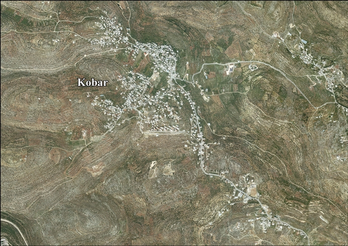
[edit]Kobar located 10.1 kilometers (6.3 mi) north of Ramallah. It is bordered by Burham to the east, Jibiya and Umm Safa to the north, al-Ittihad to the west, and al-Zaitounah and Bir Zeit to the south.[1]
History
[edit]According to the Kobar Village Council, the name "Kobar" means "the place where the gypsum was" on account of it once containing abundant gypsum deposits.[4]
Potsherds from the Iron Age, Persian/Hellenistic, Byzantine, Crusader/Ayyubid and Mamluk periods have been found in the village. The oldest sherds were found on the north and south slopes of the village, while Byzantine sherds were found on the west side.[5]
Ottoman era
[edit]Kobar was incorporated into the Ottoman Empire in 1517, and in the census of 1596, the village was located in the Nahiya of Quds of the Liwa of Quds. The population was 31 households, all Muslim. They paid a fixed tax-rate of 33,3% on wheat, barley, vineyards, fruit trees, occasional revenues, goats and/or beehives; a total of 4,000 akçe.[6] Potsherds from the early Ottoman period has also been found here.[5]
In 1838, it was noted as Kubar, a Muslim village in the Bani Zeid district, north of Jerusalem.[7]
In 1863 the French explorer Victor Guérin visited the village. He noted it had 600 inhabitants, and a mosque dedicated to a Sheikh Ahmed.[8] An Ottoman village list of about 1870 showed Kobar with a population of 220, in 48 houses, though the population count included men, only.[9][10]
In 1882, the PEF's Survey of Western Palestine (SWP) described Kobar as a "small village on a hill-top, with rock-cut tombs, and a tank, surrounded by olives."[11]
In 1896 the population of Kubar was estimated to be about 444 persons.[12]
British Mandate era
[edit]In the 1922 census of Palestine conducted by the British Mandate authorities, Kubar had a population of 447; 444 Muslims and 3 Christians[13] where the Christians were all Orthodox.[14] This had increased by the time of the 1931 census to 546, all Muslim, in 122 houses.[15]
In 1922, Tawfiq Canaan documented local traditions linking two springs to spirits. 'En el-Qubbeh was believed to be the dwelling place of es-sitt Zenab, who reportedly inflicted consequences on any unclean woman approaching the spring, resulting in permanent loss of menstruation or the death of one of her children. Another spring, 'en esh-Sharqiyeh, was said to be home to es-sitt Fattumeh, who was observed engaging in prayer at the site.[16]
In the 1945 statistics the population was 610, all Muslims,[17] while the total land area was 9,678 dunams, according to an official land and population survey.[18] Of this, 3,512 were allocated for plantations and irrigable land, 1,434 for cereals,[19] while 33 dunams were classified as built-up areas.[20]
Jordanian era
[edit]In the wake of the 1948 Arab–Israeli War, and after the 1949 Armistice Agreements, Kobar was occupied by Jordan and subsequently annexed by Jordan.
The Jordanian census of 1961 found 934 inhabitants in Kaubar.[21]
1967-present
[edit]Since the Six-Day War in 1967, Kobar has been under Israeli occupation.
After the 1995 accords, 53.7% of village land belongs to Area B, while the remaining 46.3% is Area C.[22]
In 2008, the preacher at the local mosque in Kobar, Majed Barghouti, 44, died while in detention. His relatives alleged that he had been tortured.[23][24]
Notable people from Kobar
[edit]- Fadwa Barghouti
- Marwan Barghouti
- Hussein Barghouthi (1954 – 2002)
Twin towns
[edit]References
[edit]- ^ a b Kobar Village Profile, ARIJ, p. 4
- ^ Preliminary Results of the Population, Housing and Establishments Census, 2017 (PDF). Palestinian Central Bureau of Statistics (PCBS) (Report). State of Palestine. February 2018. pp. 64–82. Retrieved 2023-10-24.
- ^ Palmer, 1881, p. 237
- ^ Kobar Village Profile, Applied Research Institute - Jerusalem (ARIJ). 2012.
- ^ a b Finkelstein et al, 1997, pp. 397-398
- ^ Hütteroth and Abdulfattah, 1977, p. 116
- ^ Robinson and Smith, 1841, vol 3, Appendix 2, p. 125
- ^ Guérin, 1869, p. 36
- ^ Socin, 1879, p. 156 It was also noted to be in the Bani Zeid district
- ^ Hartmann, 1883, p. 106, noted 51 houses
- ^ Conder and Kitchener, 1882, SWP II, p. 290
- ^ Schick, 1896, p. 126
- ^ Barron, 1923, Table VII, Sub-district of Ramallah, p. 16
- ^ Barron, 1923, Table XIV, p. 45
- ^ Mills, 1932, p. 49.
- ^ Canaan, Tawfiq (1922). "II: Haunted Springs and Water Demons in Palestine". Studies in Palestinian Customs and Folklore. Jerusalem: The Palestine Oriental Society. p. 20.
- ^ Government of Palestine, Department of Statistics, 1945, p. 26
- ^ Government of Palestine, Department of Statistics. Village Statistics, April, 1945. Quoted in Hadawi, 1970, p. 65
- ^ Government of Palestine, Department of Statistics. Village Statistics, April, 1945. Quoted in Hadawi, 1970, p. 112
- ^ Government of Palestine, Department of Statistics. Village Statistics, April, 1945. Quoted in Hadawi, 1970, p. 162
- ^ Government of Jordan, 1964, p. 24
- ^ Kobar Village Profile, ARIJ, p. 17
- ^ Hamas preacher dies while in Palestinian jail; kin allege torture, Feb. 23, 2008, Haaretz
- ^ Hamas turns West Bank funeral of leading cleric into protest against Fatah, Feb. 25, 2008, Haaretz
- ^ Walsall - Kobar Friendship Group
Bibliography
[edit]- Barron, J. B., ed. (1923). Palestine: Report and General Abstracts of the Census of 1922. Government of Palestine.
- Conder, C.R.; Kitchener, H.H. (1882). The Survey of Western Palestine: Memoirs of the Topography, Orography, Hydrography, and Archaeology. Vol. 2. London: Committee of the Palestine Exploration Fund.
- Finkelstein, I.; Lederman, Zvi, eds. (1997). Highlands of many cultures. Tel Aviv: Institute of Archaeology of Tel Aviv University Publications Section. ISBN 965-440-007-3.
- Government of Jordan, Department of Statistics (1964). First Census of Population and Housing. Volume I: Final Tables; General Characteristics of the Population (PDF).
- Government of Palestine, Department of Statistics (1945). Village Statistics, April, 1945.
- Guérin, V. (1869). Description Géographique Historique et Archéologique de la Palestine (in French). Vol. 1: Judee, pt. 3. Paris: L'Imprimerie Nationale.
- Hadawi, S. (1970). Village Statistics of 1945: A Classification of Land and Area ownership in Palestine. Palestine Liberation Organization Research Center.
- Hartmann, M. (1883). "Die Ortschaftenliste des Liwa Jerusalem in dem türkischen Staatskalender für Syrien auf das Jahr 1288 der Flucht (1871)". Zeitschrift des Deutschen Palästina-Vereins. 6: 102–149.
- Hütteroth, W.-D.; Abdulfattah, K. (1977). Historical Geography of Palestine, Transjordan and Southern Syria in the Late 16th Century. Erlanger Geographische Arbeiten, Sonderband 5. Erlangen, Germany: Vorstand der Fränkischen Geographischen Gesellschaft. ISBN 3-920405-41-2.
- Mills, E., ed. (1932). Census of Palestine 1931. Population of Villages, Towns and Administrative Areas. Jerusalem: Government of Palestine.
- Palmer, E.H. (1881). The Survey of Western Palestine: Arabic and English Name Lists Collected During the Survey by Lieutenants Conder and Kitchener, R. E. Transliterated and Explained by E.H. Palmer. Committee of the Palestine Exploration Fund.
- Robinson, E.; Smith, E. (1841). Biblical Researches in Palestine, Mount Sinai and Arabia Petraea: A Journal of Travels in the year 1838. Vol. 3. Boston: Crocker & Brewster.
- Schick, C. (1896). "Zur Einwohnerzahl des Bezirks Jerusalem". Zeitschrift des Deutschen Palästina-Vereins. 19: 120–127.
- Socin, A. (1879). "Alphabetisches Verzeichniss von Ortschaften des Paschalik Jerusalem". Zeitschrift des Deutschen Palästina-Vereins. 2: 135–163.
External links
[edit]- Welcome To Kaubar
- Survey of Western Palestine, Map 14: IAA, Wikimedia commons
- Kobar Village (Fact Sheet), Applied Research Institute–Jerusalem (ARIJ)
- Kobar Village Profile, ARIJ
- Kobar (aerial photo), ARIJ
- Locality Development Priorities and Needs in Kobar Village, ARIJ

| Authority control databases: National |
|---|